
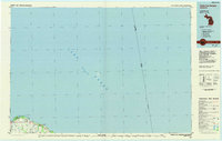
1970 Map of Huron City
USGS Topo · Published 1973About this map
Huron City sits along the northern edge of the Thumb as documented in this 1970 survey. The landscape is defined by its relationship to Lake Huron, featuring prominent coastal landmarks like Bald Eagle Point and the extensive grounds of Lighthouse County Park. Inland, the terrain is shaped by the drainage patterns of Willow Creek and its South Branch, which cut through a grid of established local thoroughfares including Hunter Rd and Mc Gardle Road.
Find a feature on this map
22 named features on this map. Tap any name to fly to it.
Don’t see what you’re looking for? This feature index may not catch every label — zoom into the map to look around manually.
Map Details
Editions of this 1970 Huron City Map
This is the sole edition of this map. No revisions or reprints were ever made.
Other maps of this area

1954 · Flint
USGS Topo · 1:250,000

1954 · Tawas City
USGS Topo · 1:250,000

1958 · Flint
USGS Topo · 1:250,000

1958 · Tawas City
USGS Topo · 1:250,000

1970 · Port Hope
USGS Topo · 1:24,000

1970 · Port Austin East
USGS Topo · 1:24,000

1970 · Kinde East
USGS Topo · 1:24,000

1970 · Redman
USGS Topo · 1:24,000

1984 · Harbor Beach
USGS Topo · 1:100,000
1984 · Pointe Aux Barques
USGS Topo · 1:100,000