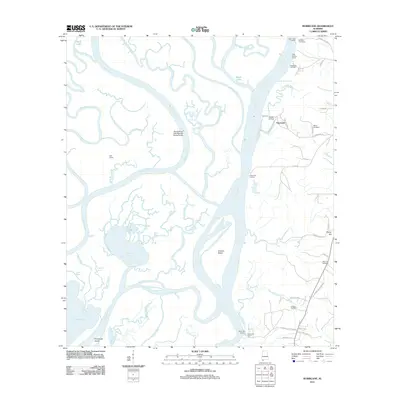
2011 Map of Hurricane
USGS Topo · Published 2011About this map
The Tensaw River and Mobile River carve a complex web of waterways through this delta landscape just north of the bay. The Hurricane settlement serves as a primary point of human activity, defined by a network of landings such as Perkins Landing and Sizemore Landing that suggest a long-standing reliance on river-based transport and recreation. The infrastructure of the Mobile River CSX Railroad Swing Bridge and Ortiz Siding highlights the critical intersection of rail and water routes in this swampy corridor.
Find a feature on this map
63 named features on this map. Tap any name to fly to it.
Don’t see what you’re looking for? This feature index may not catch every label — zoom into the map to look around manually.
Map Details
Editions of this 2011 Hurricane Map
This is the sole edition of this map. No revisions or reprints were ever made.
Other maps of this area

1921 · Fairhope
USGS Topo · 1:62,500

1922 · Mobile
USGS Topo · 1:62,500

1940 · Mobile
USGS Topo · 1:31,680

1940 · Mobile
USGS Topo · 1:62,500

1941 · Chickasaw
USGS Topo · 1:31,680

1941 · Blakeley
USGS Topo · 1:31,680

1941 · Bay Minette
USGS Topo · 1:62,500

1941 · Creola
USGS Topo · 1:62,500

1941 · Fairhope
USGS Topo · 1:62,500

1942 · Hurricane
USGS Topo · 1:31,680