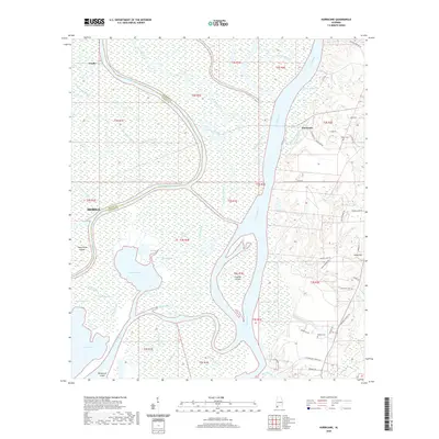
2020 Map of Hurricane
USGS Topo · Published 2020About this map
The Mobile River and Tensaw River dominate this landscape where the boundaries of Mobile and Baldwin counties meet. This intricate delta system is characterized by a complex network of waterways, including Chuckfee Bay, Grand Bay, and the winding Raft River. Small islands such as Gravine Island and Twelvemile Island sit among a labyrinth of bayous like Big Bayou Canot and Chicory Bayou. To the west, the settlement of Creola borders the wetlands, while the eastern bluffs host Stony Hill and Hurricane. Family and community history is anchored by several sites, including Miller Cem and Wilkins Cem, located along the more elevated terrain of the eastern shore. The map illustrates the sharp contrast between the uninhabited marshland of the river forks and the developing residential roads near Stony Hill Creek.
Find a feature on this map
68 named features on this map. Tap any name to fly to it.
Don’t see what you’re looking for? This feature index may not catch every label — zoom into the map to look around manually.
Map Details
Editions of this 2020 Hurricane Map
This is the sole edition of this map. No revisions or reprints were ever made.
Other maps of this area

1921 · Fairhope
USGS Topo · 1:62,500

1922 · Mobile
USGS Topo · 1:62,500

1940 · Mobile
USGS Topo · 1:31,680

1940 · Mobile
USGS Topo · 1:62,500

1941 · Chickasaw
USGS Topo · 1:31,680

1941 · Blakeley
USGS Topo · 1:31,680

1941 · Bay Minette
USGS Topo · 1:62,500

1941 · Creola
USGS Topo · 1:62,500

1941 · Fairhope
USGS Topo · 1:62,500

1942 · Hurricane
USGS Topo · 1:31,680