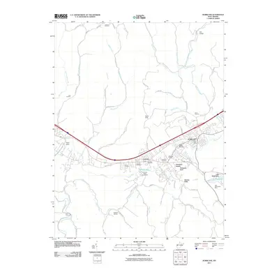
2011 Map of Hurricane
USGS Topo · Published 2011About this map
Hurricane and the neighboring settlement of Culloden form the industrial and residential spine of this West Virginia landscape, clustered along the historic James River Tpke and the Interstate corridor. The map reveals a suburban transition where established neighborhoods like Mesa Manor, Thompson Heights, and Thompson Acres give way to the more rural drainage basins of Hurricane Creek and Charleys Creek. To the east, Lake Washington and its associated dam create a focal point for recreation, while the Culloden Water Supply Dam at Culloden Lake anchors the local infrastructure.
Find a feature on this map
75 named features on this map. Tap any name to fly to it.
Don’t see what you’re looking for? This feature index may not catch every label — zoom into the map to look around manually.
Map Details
Editions of this 2011 Hurricane Map
This is the sole edition of this map. No revisions or reprints were ever made.
Other maps of this area

1892 · Huntington
USGS Topo · 1:125,000

1898 · Huntington
USGS Topo · 1:125,000

1899 · Charleston
USGS Topo · 1:125,000

1902 · Milton
USGS Topo · 1:62,500

1906 · Glenwood
USGS Topo · 1:62,500

1906 · Winfield
USGS Topo · 1:62,500

1908 · Glenwood
USGS Topo · 1:62,500

1908 · Winfield
USGS Topo · 1:62,500

1909 · Saint Albans
USGS Topo · 1:62,500

1931 · Saint Albans
USGS Topo · 1:62,500