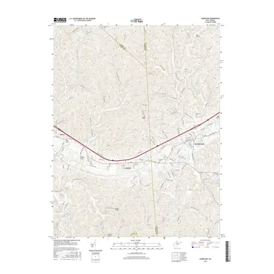
2016 Map of Hurricane
USGS Topo · Published 2016About this map
Hurricane and the surrounding communities of Culloden and Milton are situated along a vital east-west transportation corridor where the James River Tpke once influenced local development. This modern topographic study reveals the dense network of local roads and state routes, such as Virginia Ave and Central Dr, that tie these towns together across the Cabell and Putnam county lines. The terrain is characterized by intricate creek systems including Hurricane Creek and the Mud River, which have carved deep hollows like Mill Hollow and Hudson Hollow into the landscape.
Find a feature on this map
127 named features on this map. Tap any name to fly to it.
Don’t see what you’re looking for? This feature index may not catch every label — zoom into the map to look around manually.
Map Details
Editions of this 2016 Hurricane Map
This is the sole edition of this map. No revisions or reprints were ever made.
Other maps of this area

1892 · Huntington
USGS Topo · 1:125,000

1898 · Huntington
USGS Topo · 1:125,000

1899 · Charleston
USGS Topo · 1:125,000

1902 · Milton
USGS Topo · 1:62,500

1906 · Glenwood
USGS Topo · 1:62,500

1906 · Winfield
USGS Topo · 1:62,500

1908 · Glenwood
USGS Topo · 1:62,500

1908 · Winfield
USGS Topo · 1:62,500

1909 · Saint Albans
USGS Topo · 1:62,500

1931 · Saint Albans
USGS Topo · 1:62,500