2023 Map of Hurricane
USGS Topo · Published 2023About this map
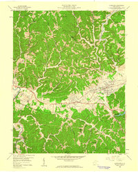
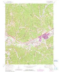
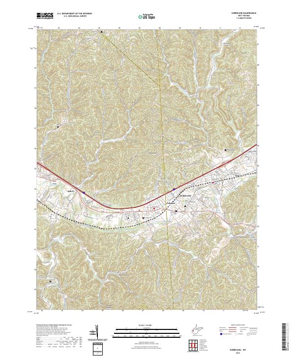
The Mud River meanders through this portion of West Virginia, marking a landscape where the urban developments of Milton and Hurricane meet the ridgelines and hollows of the Teays Valley. This 2023 survey provides a contemporary view of the region's transport network, centered on the James River Tpke and its modern highway counterparts. The area between Culloden and Hurricane is particularly dense with local landmarks, including the Valley View Memorial Park Cem and Culloden Lake. Along the northern edge, the terrain rises toward Signal Knob and Laural Ridge, while numerous cemeteries like Lundsford Cem and Neal Cem are tucked into the drainages of Mill Creek and Johns Branch. The map preserves the many family-named hollows and branches, such as Wolfpen Hollow and Poindexter Branch, that define the local geography outside the primary residential corridors of Kingswood Ests.
Find a feature on this map
137 named features on this map. Tap any name to fly to it.
Don’t see what you’re looking for? This feature index may not catch every label — zoom into the map to look around manually.
Map Details
Editions of this 2023 Hurricane Map
This is the sole edition of this map. No revisions or reprints were ever made.
Historical Maps of Imperial Estates Through Time
3 maps found