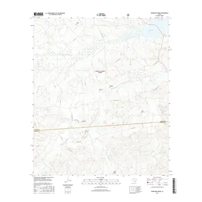
2016 Map of Hurricane Creek
USGS Topo · Published 2016About this map
The Sabine National Forest dominates this East Texas landscape, where the boundary between Sabine and Newton counties is traced across a network of creeks and timberland. In the northeastern corner, the Toledo Bend Reservoir meets the shoreline near Conner Creek, marking a significant water feature for the region. The map reveals a high density of family burial sites, reflecting the deep-rooted genealogical history of the area. These include the Wilkerson Family Cem, Deas-Mason-Smith Cem, and Anderson Bowie Cem, which are scattered among the forest service roads and local routes like Clarktown Rd. The topography is defined by the drainages of Hurricane Creek and its seasonal counterparts, Dry Hurricane Creek and Wet Hurricane Creek, while the private Scrappin Valley Airport and Scrappin Valley Lake sit in the southern reaches of the quadrangle.
Find a feature on this map
43 named features on this map. Tap any name to fly to it.
Don’t see what you’re looking for? This feature index may not catch every label — zoom into the map to look around manually.
Map Details
Editions of this 2016 Hurricane Creek Map
This is the sole edition of this map. No revisions or reprints were ever made.
Other maps of this area

1944 · Negreet
USGS Topo · 1:62,500

1944 · Wiergate
USGS Topo · 1:62,500

1948 · Wiergate
USGS Topo · 1:62,500

1953 · Alexandria
USGS Topo · 1:250,000

1954 · Wiergate
USGS Topo · 1:24,000

1954 · Columbus
USGS Topo · 1:24,000

1954 · Fairdale
USGS Topo · 1:24,000

1954 · Negreet
USGS Topo · 1:62,500

1954 · Wiergate
USGS Topo · 1:62,500

1955 · Alexandria
USGS Topo · 1:250,000