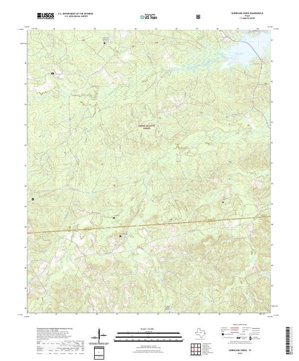
2022 Map of Hurricane Creek
USGS Topo · Published 2022About this map
Sabine National Forest dominates this East Texas landscape, where the dense woodlands of the Piney Woods meet the western reaches of the Toledo Bend Reservoir. This survey captures the rural character of the border between Sabine County and Newton County, defined by a network of creeks like Sixmile Creek and Hurricane Creek that drain through the timberland. For genealogists, the map is particularly valuable for locating established family landmarks and burial sites, including the Pleasant Hill Methodist Church Cemetery and the Clark Clarkton Cemetery near Clarktown Road. Small clearings in the forest reveal community hubs such as Six Mile Village and the private airstrip at Scrappin Valley Airport. The intricate system of Forest Service roads, such as Nat For Dev Rd 111, highlights the ongoing intersection of public land management and local navigation in this secluded timber region.
Find a feature on this map
45 named features on this map. Tap any name to fly to it.
Don’t see what you’re looking for? This feature index may not catch every label — zoom into the map to look around manually.
Map Details
Editions of this 2022 Hurricane Creek Map
This is the sole edition of this map. No revisions or reprints were ever made.
Other maps of this area

1944 · Negreet
USGS Topo · 1:62,500

1944 · Wiergate
USGS Topo · 1:62,500

1948 · Wiergate
USGS Topo · 1:62,500

1953 · Alexandria
USGS Topo · 1:250,000

1954 · Wiergate
USGS Topo · 1:24,000

1954 · Columbus
USGS Topo · 1:24,000

1954 · Fairdale
USGS Topo · 1:24,000

1954 · Negreet
USGS Topo · 1:62,500

1954 · Wiergate
USGS Topo · 1:62,500

1955 · Alexandria
USGS Topo · 1:250,000