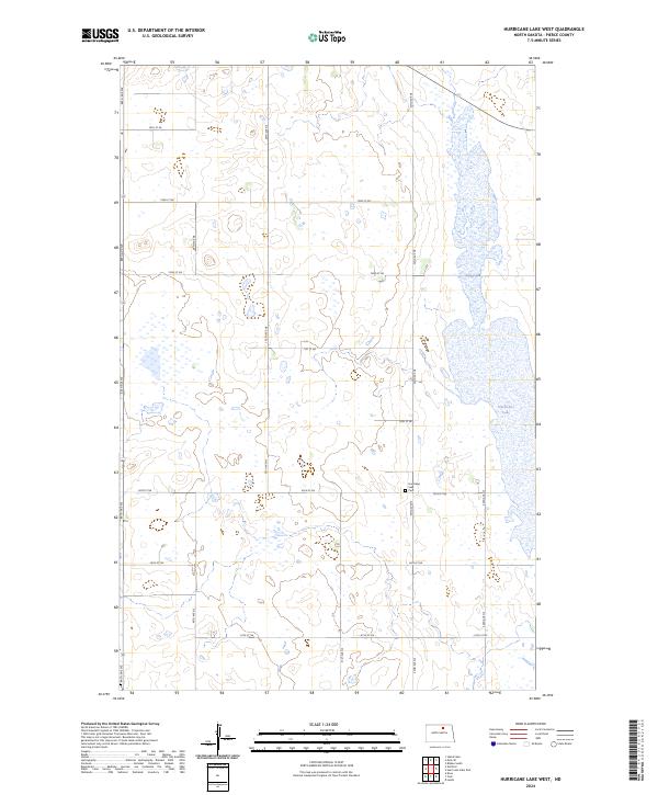
2024 Map of Hurricane Lake West
USGS Topo · Published 2024About this map
Hurricane Lake Cem sits as a quiet landmark amidst the glacial prairie of Pierce County, serving as a primary point of historical interest in this agricultural landscape. The surrounding terrain is defined by the expansive Hurricane Lake, which dominates the eastern edge of the survey. The land management patterns here reflect a strong emphasis on conservation, most notably within the Pierce County Waterfowl Production Area. This protected space, integrated into the township grid system of t158n r69w and t157n r69w, illustrates the regional commitment to preserving North Dakota's wetland habitats while maintaining the section-line road network that facilitates rural access. The map reveals a high density of small prairie potholes and marshes characteristic of the northern plains, networked by a grid of local thoroughfares like 50th Ave NE and 72nd St NE.
Find a feature on this map
21 named features on this map. Tap any name to fly to it.
Don’t see what you’re looking for? This feature index may not catch every label — zoom into the map to look around manually.
Map Details
Editions of this 2024 Hurricane Lake West Map
This is the sole edition of this map. No revisions or reprints were ever made.
Other maps of this area

1953 · Devils Lake
USGS Topo · 1:250,000

1956 · Devils Lake
USGS Topo · 1:250,000

1971 · Wolford
USGS Topo · 1:24,000

1971 · Bisbee South
USGS Topo · 1:24,000

1971 · Island Lake
USGS Topo · 1:24,000

1971 · Knox
USGS Topo · 1:24,000

1971 · Hurricane Lake West
USGS Topo · 1:24,000

1971 · York
USGS Topo · 1:24,000

1971 · Leeds
USGS Topo · 1:24,000

1971 · Mylo SE
USGS Topo · 1:24,000