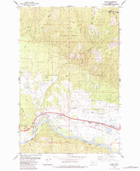
1984 Map of Huson
USGS Topo · Published 1984About this map
The settlement of Huson serves as a focal point along the northern bank of the Clark Fork river, where the valley floor transitions into the timbered slopes of the Lolo National Forest. This 1984 survey documents a landscape defined by water management and transit, featuring the Frenchtown Irrigation District Ditch and the Burlington Northern railroad corridor. Historical travel routes are prominent throughout the quadrangle, from the established Mullan Road and Burlington Road near the river to the Sixmile (Pack) Trail and Edith Peak Road climbing toward the northern heights. The presence of an Old Railroad Grade and numerous gravel pits suggests the area's ongoing industrial and infrastructural development during the late twentieth century. In the high country, Edith Peak marks the boundary between Sanders and Missoula counties, overlooking a network of drainages including Sixmile Creek and Houle Creek.
Find a feature on this map
25 named features on this map. Tap any name to fly to it.
Don’t see what you’re looking for? This feature index may not catch every label — zoom into the map to look around manually.
Map Details
Editions of this 1984 Huson Map
2 editions found
Other maps of this area

1912 · Missoula
USGS Topo · 1:125,000

1956 · Wallace
USGS Topo · 1:250,000

1956 · Hamilton
USGS Topo · 1:250,000

1959 · Hamilton
USGS Topo · 1:250,000

1959 · Alberton
USGS Topo · 1:62,500

1959 · Arlee
USGS Topo · 1:62,500

1960 · Wallace
USGS Topo · 1:250,000

1960 · Hamilton
USGS Topo · 1:250,000

1963 · Primrose
USGS Topo · 1:24,000

1964 · Hamilton
USGS Topo · 1:250,000