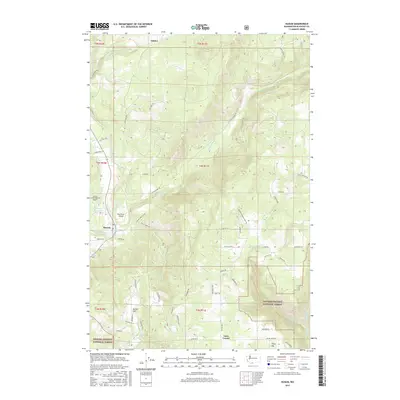
2017 Map of Husum
USGS Topo · Published 2017About this map
Husum serves as a central hub in this corner of Klickitat County, situated where the White Salmon River meets a network of local roads including Fordyce Rd and Fairway Dr. The landscape is defined by the sharp transition from the river valley to the elevated timberlands of the Gifford Pinchot National Forest in the southwest and the rising slopes of Tracy Hill to the southeast. To the north, the settlement of Gilmer and the high drainage of Rattlesnake Cr indicate a more dispersed rural pattern of homesteads and winding mountain routes like Oak Ridge Rd. The presence of small aviation facilities such as Spring Creek Ranch Airport and Port Elsner Airport underscores the area's role as a gateway to the Columbia River Gorge backcountry, while landmarks like Laws Corner and McCoy Flat mark the intersections of long-standing forest and ranching routes.
Find a feature on this map
63 named features on this map. Tap any name to fly to it.
Don’t see what you’re looking for? This feature index may not catch every label — zoom into the map to look around manually.
Map Details
Editions of this 2017 Husum Map
This is the sole edition of this map. No revisions or reprints were ever made.
Other maps of this area

1926 · Hood River
USGS Topo · 1:125,000

1929 · Hood River
USGS Topo · 1:125,000

1934 · The Dalles
USGS Topo · 1:125,000

1953 · The Dalles
USGS Topo · 1:250,000

1956 · The Dalles
USGS Topo · 1:250,000

1957 · The Dalles
USGS Topo · 1:250,000

1957 · Willard
USGS Topo · 1:62,500

1957 · White Salmon
USGS Topo · 1:62,500

1957 · Husum
USGS Topo · 1:62,500

1957 · Hood River
USGS Topo · 1:62,500