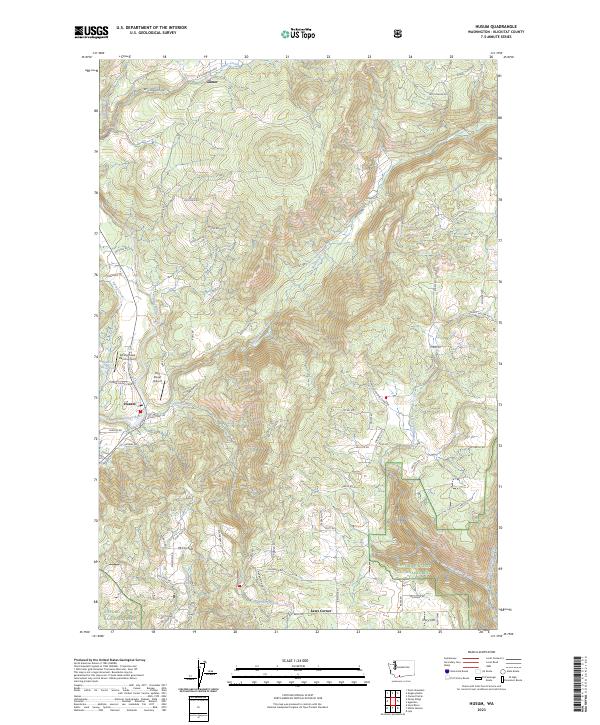
2023 Map of Husum
USGS Topo · Published 2023About this map
The White Salmon River, designated here as the White Salmon Wild and Scenic River, carves through the landscape near the community of Husum. This region of Klickitat County is defined by its transition from the agricultural flats of McCoy Flat to the timbered reaches of the Gifford Pinchot National Forest. Aviation infrastructure is notably present with the Spring Creek Ranch Airport and Port Elsner Airport serving the area. Local history is reflected in the network of rural roads such as Indian Cemetery Rd and B Z Glenwood Hwy, which connect established settlements like Gilmer and Laws Corner. The map captures a sophisticated water system including Spencer Reservoir and numerous tributaries like Rattlesnake Creek and Indian Creek, illustrating how the drainage patterns off Tracy Hill shape the local geography and land use.
Find a feature on this map
68 named features on this map. Tap any name to fly to it.
Don’t see what you’re looking for? This feature index may not catch every label — zoom into the map to look around manually.
Map Details
Editions of this 2023 Husum Map
This is the sole edition of this map. No revisions or reprints were ever made.
Other maps of this area

1926 · Hood River
USGS Topo · 1:125,000

1929 · Hood River
USGS Topo · 1:125,000

1934 · The Dalles
USGS Topo · 1:125,000

1953 · The Dalles
USGS Topo · 1:250,000

1956 · The Dalles
USGS Topo · 1:250,000

1957 · The Dalles
USGS Topo · 1:250,000

1957 · Willard
USGS Topo · 1:62,500

1957 · White Salmon
USGS Topo · 1:62,500

1957 · Husum
USGS Topo · 1:62,500

1957 · Hood River
USGS Topo · 1:62,500