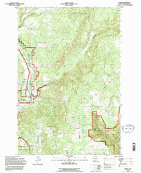
1994 Map of Husum
USGS Topo · Published 1996About this map
The White Salmon Wild and Scenic River carves a deep path through this corner of Klickitat County, defining the local landscape near the settlement of Husum. Revised from 1993 aerial photography, the map reveals a region of transition where the Gifford Pinchot National Forest meets private timber and ranch lands. Small rural outposts like Gilmer and Laws Corner are connected by a network of forest roads and historic routes such as Snowden Road and Bristol Road. In the south, the terrain descends toward the Columbia River Gorge National Scenic Area, marked by the steep drainages of Major Creek and Jewett Creek. This cartographic record is particularly valuable for tracing local land use, from the GPNF Substation and various Gravel Pits to the recreational Golf Course and the unnamed Cemetery situated on the ridge overlooking the river valley.
Find a feature on this map
47 named features on this map. Tap any name to fly to it.
Don’t see what you’re looking for? This feature index may not catch every label — zoom into the map to look around manually.
Map Details
Editions of this 1994 Husum Map
This is the sole edition of this map. No revisions or reprints were ever made.
Other maps of this area

1926 · Hood River
USGS Topo · 1:125,000

1929 · Hood River
USGS Topo · 1:125,000

1934 · The Dalles
USGS Topo · 1:125,000

1953 · The Dalles
USGS Topo · 1:250,000

1956 · The Dalles
USGS Topo · 1:250,000

1957 · The Dalles
USGS Topo · 1:250,000

1957 · Willard
USGS Topo · 1:62,500

1957 · White Salmon
USGS Topo · 1:62,500

1957 · Husum
USGS Topo · 1:62,500

1957 · Hood River
USGS Topo · 1:62,500