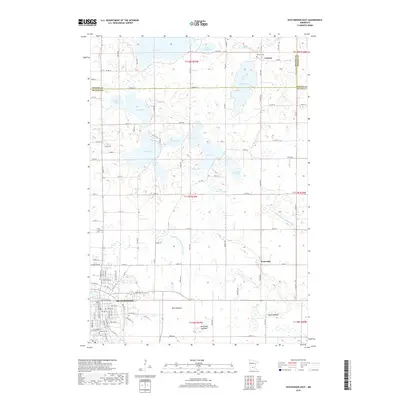
2019 Map of Hutchinson East
USGS Topo · Published 2019About this map
Hutchinson anchors the southwestern portion of this map, showing the dense street grid and historic core along the S Fork Crow River. The city's growth is marked by established residential streets like Washington Ave E and proximity to the Railroad St corridor. To the north and east, the landscape transitions into a complex mosaic of glacial lakes and drainage systems, including Lake Hook, Bear Lake, and Lake Byron. The mapping of areas like Mud Lakebed and Benjamin Lakebed reveals the evolving hydrology of this prairie-pothole region, where water levels have shifted over time.
Find a feature on this map
67 named features on this map. Tap any name to fly to it.
Don’t see what you’re looking for? This feature index may not catch every label — zoom into the map to look around manually.
Map Details
Editions of this 2019 Hutchinson East Map
This is the sole edition of this map. No revisions or reprints were ever made.
Other maps of this area

1953 · New Ulm
USGS Topo · 1:250,000

1953 · Saint Cloud
USGS Topo · 1:250,000

1957 · Saint Cloud
USGS Topo · 1:250,000

1957 · New Ulm
USGS Topo · 1:250,000

1958 · New Ulm
USGS Topo · 1:250,000

1958 · Saint Cloud
USGS Topo · 1:250,000

1958 · Glencoe
USGS Topo · 1:62,500

1958 · Dassel
USGS Topo · 1:62,500

1958 · Cokato
USGS Topo · 1:62,500

1958 · Hutchinson
USGS Topo · 1:62,500