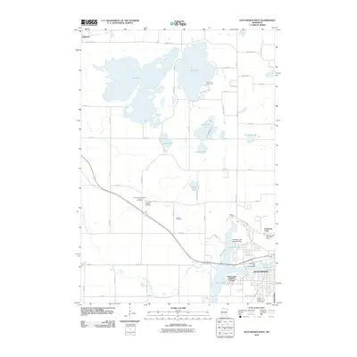
2010 Map of Hutchinson West
USGS Topo · Published 2010About this map
Cedar Lake and Belle Lake dominate the northern landscape of this region, providing a significant glacial lake system that has long influenced the local geography. Toward the southeast, the residential expansion of Hutchinson is evident, including developments like Northview Court and McDonalds Lakeview Terrace near the shores of Otter Lake. The South Fork Crow River meanders through the southern portion of the quadrangle, south of the Luce Line Trl, which follows a former rail corridor.
Find a feature on this map
61 named features on this map. Tap any name to fly to it.
Don’t see what you’re looking for? This feature index may not catch every label — zoom into the map to look around manually.
Map Details
Editions of this 2010 Hutchinson West Map
This is the sole edition of this map. No revisions or reprints were ever made.
Other maps of this area

1953 · New Ulm
USGS Topo · 1:250,000

1953 · Saint Cloud
USGS Topo · 1:250,000

1957 · Saint Cloud
USGS Topo · 1:250,000

1957 · New Ulm
USGS Topo · 1:250,000

1958 · New Ulm
USGS Topo · 1:250,000

1958 · Saint Cloud
USGS Topo · 1:250,000

1958 · Dassel
USGS Topo · 1:62,500

1958 · Hutchinson
USGS Topo · 1:62,500

1967 · New Ulm
USGS Topo · 1:250,000

1967 · Litchfield South
USGS Topo · 1:24,000