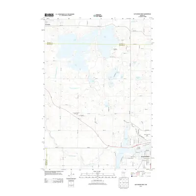
2013 Map of Hutchinson West
USGS Topo · Published 2013About this map
The S Fork Crow River snakes through this agricultural landscape, connecting the northwestern fringes of Hutchinson with the surrounding glacial lakes of central Minnesota. Significant water bodies like Belle Lake, Cedar Lake, and Otter Lake dominate the northern and eastern portions of the terrain, while County Ditch Number Three illustrates the area's extensive hydrological management for farming. Genealogists will find notable value in several distinct burial grounds, including the Emmanuel Evangelical Lutheran Cem, Emmanuel Lutheran Cem, Acoma Cem, and Peace Cem. The settlement of Greenleaf stands in the far northwest, while the road network is anchored by MN-7 and MN-15. Public spaces such as Piepenburg Campground and the Meadow Links Public Golf Course mark the transition from rural fields to the growing municipal footprint of Hutchinson.
Find a feature on this map
54 named features on this map. Tap any name to fly to it.
Don’t see what you’re looking for? This feature index may not catch every label — zoom into the map to look around manually.
Map Details
Editions of this 2013 Hutchinson West Map
This is the sole edition of this map. No revisions or reprints were ever made.
Other maps of this area

1953 · New Ulm
USGS Topo · 1:250,000

1953 · Saint Cloud
USGS Topo · 1:250,000

1957 · Saint Cloud
USGS Topo · 1:250,000

1957 · New Ulm
USGS Topo · 1:250,000

1958 · New Ulm
USGS Topo · 1:250,000

1958 · Saint Cloud
USGS Topo · 1:250,000

1958 · Dassel
USGS Topo · 1:62,500

1958 · Hutchinson
USGS Topo · 1:62,500

1967 · New Ulm
USGS Topo · 1:250,000

1967 · Litchfield South
USGS Topo · 1:24,000