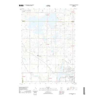
2019 Map of Hutchinson West
USGS Topo · Published 2019About this map
Hutchinson serves as the primary urban center in this western McLeod County landscape, where the South Fork Crow River snakes through the southern townships. The 2019 survey documents a region defined by its numerous water bodies, including the expansive Belle Lake and Cedar Lake near the northern boundary. Rural life and genealogy are well-represented through several significant burial grounds, such as Greenleaf Cem, Immanuel Evangelical Lutheran Cem, and Acoma Cem, which sit alongside established farm-to-market roads like Co Rd 18 and Co Hwy 20. In the northwestern corner, the small settlement of Greenleaf marks a long-standing local community. Recreational spaces like Piepenburg Park on the shores of Belle Lake indicate how the natural lake system has been integrated into local public life while maintaining the area's agricultural character.
Find a feature on this map
66 named features on this map. Tap any name to fly to it.
Don’t see what you’re looking for? This feature index may not catch every label — zoom into the map to look around manually.
Map Details
Editions of this 2019 Hutchinson West Map
This is the sole edition of this map. No revisions or reprints were ever made.
Other maps of this area

1953 · New Ulm
USGS Topo · 1:250,000

1953 · Saint Cloud
USGS Topo · 1:250,000

1957 · Saint Cloud
USGS Topo · 1:250,000

1957 · New Ulm
USGS Topo · 1:250,000

1958 · New Ulm
USGS Topo · 1:250,000

1958 · Saint Cloud
USGS Topo · 1:250,000

1958 · Dassel
USGS Topo · 1:62,500

1958 · Hutchinson
USGS Topo · 1:62,500

1967 · New Ulm
USGS Topo · 1:250,000

1967 · Litchfield South
USGS Topo · 1:24,000