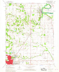
1966 Map of Hutsonville
USGS Topo · Published 1967About this map
The Indian Treaty Boundary cuts diagonally through this mid-1960s landscape, serving as a historic reminder of early nineteenth-century land partitions. The area is anchored by the industrial and civic activity in Robinson, where the Courthouse and Post Office sit near several educational landmarks including Washington Sch and Lincoln Sch. Transport and commerce follow the New York Central rail line, which links the county seat with smaller settlements like Trimble and Gordon. Along the eastern edge, the Wabash River shows significant modification via the Hutsonville Cutoff near the village of Hutsonville. The rural stretches between these hubs are dotted with genealogical landmarks such as Barbee Cem and Newlin Cem, alongside community centers like Grand Prairie Ch and Lamotte Prairie Ch.
Find a feature on this map
43 named features on this map. Tap any name to fly to it.
Don’t see what you’re looking for? This feature index may not catch every label — zoom into the map to look around manually.
Map Details
Editions of this 1966 Hutsonville Map
2 editions found
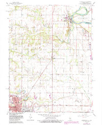
Other maps of this area

1910 · Hardinville
USGS Topo · 1:62,500

1917 · Birds
USGS Topo · 1:62,500

1942 · Fairbanks
USGS Topo · 1:24,000

1942 · Birds
USGS Topo · 1:62,500

1943 · Merom
USGS Topo · 1:24,000

1952 · Fairbanks
USGS Topo · 1:24,000

1953 · Indianapolis
USGS Topo · 1:250,000

1956 · Indianapolis
USGS Topo · 1:250,000

1956 · Annapolis
USGS Topo · 1:62,500

1956 · Vincennes
USGS Topo · 1:250,000