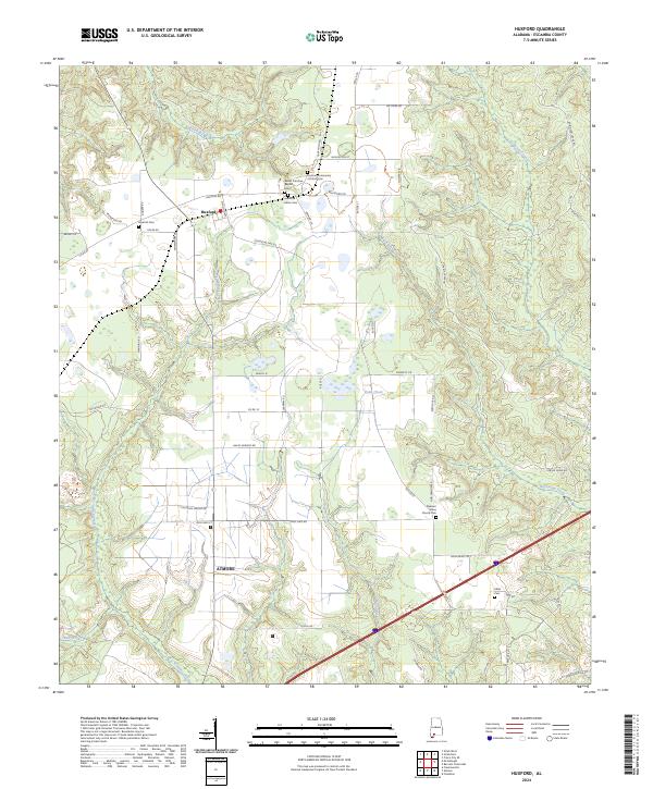
2024 Map of Huxford
USGS Topo · Published 2024About this map
Huxford and the northern outskirts of Atmore anchor this section of Escambia County, where the landscape is defined by a dense network of tributaries and rural burial grounds. The community of Huxford is a central point of interest for genealogists, featuring several distinct sites including the Huxford Cem., the Huxford Indian Cem, and the Huxford Community of Christ Cem. This concentration of cemeteries, along with the Sardis Primitive Baptist Cem, suggests a long-standing settlement pattern tied to family lineages and local congregations.
Find a feature on this map
60 named features on this map. Tap any name to fly to it.
Don’t see what you’re looking for? This feature index may not catch every label — zoom into the map to look around manually.
Map Details
Editions of this 2024 Huxford Map
This is the sole edition of this map. No revisions or reprints were ever made.
Other maps of this area

1942 · Perdido
USGS Topo · 1:62,500

1944 · Perdido
USGS Topo · 1:62,500

1953 · Andalusia
USGS Topo · 1:250,000

1957 · Andalusia
USGS Topo · 1:250,000

1960 · Atmore
USGS Topo · 1:24,000

1960 · Huxford
USGS Topo · 1:24,000

1960 · Barnett Crossroads
USGS Topo · 1:24,000
1960 · Flomaton
USGS Topo · 1:24,000

1972 · Frisco City SE
USGS Topo · 1:24,000

1972 · Uriah East
USGS Topo · 1:24,000