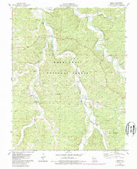
1978 Map of Huzzah
USGS Topo · Published 1985About this map
Huzzah Creek and Courtois Creek wind through the timbered hills of the Mark Twain National Forest in this late 1970s survey. The landscape is defined by its water, from the Fish Hatchery at Westover to the numerous springs like Hickman Spring and Gibbs Spring that feed the local drainages. Geologic and geographic features like the Lower Narrows and Upper Narrows mark the rugged passage of the creek through the northern portion of the quadrangle.
Find a feature on this map
44 named features on this map. Tap any name to fly to it.
Don’t see what you’re looking for? This feature index may not catch every label — zoom into the map to look around manually.
Map Details
Editions of this 1978 Huzzah Map
2 editions found
Other maps of this area

1903 · Sullivan
USGS Topo · 1:125,000

1932 · Steelville
USGS Topo · 1:48,000

1933 · Steelville
USGS Topo · 1:62,500

1937 · Steelville
USGS Topo · 1:62,500

1943 · Berryman
USGS Topo · 1:62,500

1945 · Berryman
USGS Topo · 1:62,500

1947 · Sullivan
USGS Topo · 1:62,500

1948 · Leasburg
USGS Topo · 1:24,000

1949 · Saint Louis
USGS Topo · 1:250,000

1949 · Sullivan
USGS Topo · 1:62,500