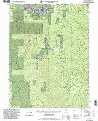
1998 Map of Hyampom
USGS Topo · Published 2003About this map
The South Fork Trinity River carves a deep path through the heart of the Shasta Trinity National Forests in this late 20th-century survey. The settlement of Hyampom serves as the focal point of the northern valley, supported by an adjacent Airstrip and a small Cem near the riverbanks. The landscape is defined by isolated family outposts such as Marcels Ranch, Grey Ranch, and French Ranch, which are situated along the river's winding course and the surrounding flats.
Find a feature on this map
41 named features on this map. Tap any name to fly to it.
Don’t see what you’re looking for? This feature index may not catch every label — zoom into the map to look around manually.
Map Details
Editions of this 1998 Hyampom Map
This is the sole edition of this map. No revisions or reprints were ever made.
Other maps of this area

1909 · Big Bar
USGS Topo · 1:96,000

1914 · Pilot Creek
USGS Topo · 1:62,500

1915 · Big Bar and Vicinity
USGS Topo · 1:250,000

1918 · Anada
USGS Topo · 1:62,500

1931 · Hoaglin
USGS Topo · 1:96,000

1935 · Hoaglin
USGS Topo · 1:125,000

1949 · Blocksburg
USGS Topo · 1:62,500

1951 · Blocksburg
USGS Topo · 1:62,500

1951 · Pilot Creek
USGS Topo · 1:62,500

1951 · Hyampom
USGS Topo · 1:62,500