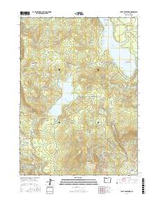
2017 Map of Hyatt Reservoir
USGS Topo · Published 2017About this map
Hyatt Reservoir and the southern reaches of Howard Prairie Lake dominate this high-elevation landscape in Jackson County. The region is defined by its complex water management infrastructure, including the Howard Prairie Canal and Keene Cr Reservoir. Traversing the terrain from north to south is a significant section of the Pacific Crest National Scenic Trail, which winds past Little Hyatt Reservoir and climbs toward the Green Springs Summit. Numerous meadows and glades, such as Wildcat Glades, Crane Prairie, and Hyatt Meadows, break the timbered slopes of peaks like Chinquapin Mtn. An extensive network of forest access roads, including Grizzly Prairie Rd and Hyatt Prairie Rd, provides a record of the area's development for recreation and resource management by the late 2010s.
Find a feature on this map
62 named features on this map. Tap any name to fly to it.
Don’t see what you’re looking for? This feature index may not catch every label — zoom into the map to look around manually.
Map Details
Editions of this 2017 Hyatt Reservoir Map
This is the sole edition of this map. No revisions or reprints were ever made.
Other maps of this area

1891 · Ashland
USGS Topo · 1:250,000

1893 · Ashland
USGS Topo · 1:250,000

1897 · Ashland
USGS Topo · 1:250,000

1938 · Medford
USGS Topo · 1:125,000

1954 · Lakecreek
USGS Topo · 1:62,500

1954 · Ashland
USGS Topo · 1:62,500

1955 · Hyatt Reservoir
USGS Topo · 1:62,500

1955 · Mt. Mc Loughlin
USGS Topo · 1:62,500

1955 · Medford
USGS Topo · 1:250,000

1957 · Medford
USGS Topo · 1:250,000