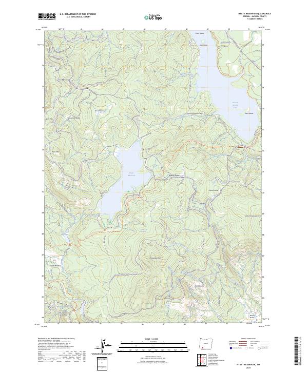
2024 Map of Hyatt Reservoir
USGS Topo · Published 2024About this map
Cascade-Siskiyou National Monument anchors this southern Oregon landscape, where the high-altitude hydrology of the Cascades is heavily managed through a network of reservoirs and canals. The map showcases significant water infrastructure, including the large Howard Prairie Lake and Hyatt Reservoir, which are linked by the Howard Prairie Canal. This system of reservoirs, which also includes Little Hyatt Reservoir and Keene Cr Reservoir, illustrates the mid-century engineering used to divert and store water across the rugged Jackson County terrain.
Find a feature on this map
63 named features on this map. Tap any name to fly to it.
Don’t see what you’re looking for? This feature index may not catch every label — zoom into the map to look around manually.
Map Details
Editions of this 2024 Hyatt Reservoir Map
This is the sole edition of this map. No revisions or reprints were ever made.
Other maps of this area

1891 · Ashland
USGS Topo · 1:250,000

1893 · Ashland
USGS Topo · 1:250,000

1897 · Ashland
USGS Topo · 1:250,000

1938 · Medford
USGS Topo · 1:125,000

1954 · Lakecreek
USGS Topo · 1:62,500

1954 · Ashland
USGS Topo · 1:62,500

1955 · Hyatt Reservoir
USGS Topo · 1:62,500

1955 · Mt. Mc Loughlin
USGS Topo · 1:62,500

1955 · Medford
USGS Topo · 1:250,000

1957 · Medford
USGS Topo · 1:250,000