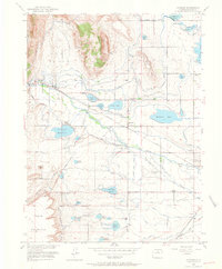
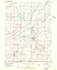
1950 Map of Hygiene
USGS Topo · Published 1964About this map
Hygiene sits at the center of an intricate agricultural network of canals and reservoirs north of Boulder, a landscape defined by its dependency on water management at the base of Rabbit Mountain. The 1950s topography reveals a transition from the steeper terrain of Potato Hill and Table Mountain down to the fertile plains fed by St Vrain Creek. This era shows a community in flux, with several educational landmarks like Montgomery School and Nelson School still standing, while others like Bashor School are already noted as abandoned. The presence of the Ryssby Ch and numerous family-named landmarks like Mc Call Lake and Mc Caslin Lake provide a rich record for genealogists tracing local heritage. Transportation is anchored by the Colorado and Southern railroad and the Longmont Airport, supporting the local economy alongside the industrial Brickyard and gravel pits.
Find a feature on this map
61 named features on this map. Tap any name to fly to it.
Don’t see what you’re looking for? This feature index may not catch every label — zoom into the map to look around manually.
Map Details
Editions of this 1950 Hygiene Map
5 editions found
Other maps of this area

1902 · Boulder
USGS Topo · 1:62,500

1904 · Niwot
USGS Topo · 1:62,500

1904 · Boulder
USGS Topo · 1:62,500

1905 · Mount Olympus
USGS Topo · 1:62,500

1906 · Loveland
USGS Topo · 1:62,500

1907 · Mount Olympus
USGS Topo · 1:62,500

1908 · Loveland
USGS Topo · 1:62,500

1950 · Hygiene
USGS Topo · 1:24,000
1950 · Erie
USGS Topo · 1:24,000

1950 · Niwot
USGS Topo · 1:24,000