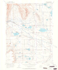
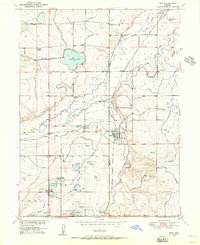
1950 Map of Hygiene
USGS Topo · Published 1964About this map
The settlement of Hygiene and the surrounding agricultural plains of Boulder County are defined by an intricate network of irrigation ditches and reservoirs designed to manage the waters of ST Vrain Creek. This 1950 survey documents the rural character of the region before significant suburban expansion, highlighting several local educational landmarks such as Montgomery School, Nelson School, and the Hygiene School (Aband). To the west, the topography rises toward Rabbit Mountain and the Hogback, where Lykins Gulch cuts through the rising terrain.
Find a feature on this map
50 named features on this map. Tap any name to fly to it.
Don’t see what you’re looking for? This feature index may not catch every label — zoom into the map to look around manually.
Map Details
Editions of this 1950 Hygiene Map
5 editions found
Other maps of this area

1902 · Boulder
USGS Topo · 1:62,500

1904 · Niwot
USGS Topo · 1:62,500

1904 · Boulder
USGS Topo · 1:62,500

1905 · Mount Olympus
USGS Topo · 1:62,500

1906 · Loveland
USGS Topo · 1:62,500

1907 · Mount Olympus
USGS Topo · 1:62,500

1908 · Loveland
USGS Topo · 1:62,500

1950 · Hygiene
USGS Topo · 1:24,000
1950 · Erie
USGS Topo · 1:24,000

1950 · Niwot
USGS Topo · 1:24,000