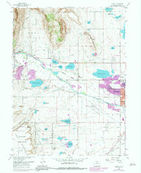
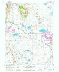
1968 Map of Hygiene
USGS Topo · Published 1984About this map
The agrarian and industrial landscape of northern Boulder, Colorado, is defined by an intricate network of irrigation canals and reservoirs essential for life on the high plains. The settlement of Hygiene sits at the center of this web, where the Northern Ditch and Oligarchy Ditch distribute water across the territory. To the south and west, the terrain rises toward Rabbit Mountain and Table Mountain, the latter of which serves as a technological hub featuring Antenna Field Sites, Radio Telescopes, and Parabolic Antennas.
Find a feature on this map
65 named features on this map. Tap any name to fly to it.
Don’t see what you’re looking for? This feature index may not catch every label — zoom into the map to look around manually.
Map Details
Editions of this 1968 Hygiene Map
5 editions found
Other maps of this area

1902 · Boulder
USGS Topo · 1:62,500

1904 · Niwot
USGS Topo · 1:62,500

1904 · Boulder
USGS Topo · 1:62,500

1905 · Mount Olympus
USGS Topo · 1:62,500

1906 · Loveland
USGS Topo · 1:62,500

1907 · Mount Olympus
USGS Topo · 1:62,500

1908 · Loveland
USGS Topo · 1:62,500

1950 · Hygiene
USGS Topo · 1:24,000
1950 · Erie
USGS Topo · 1:24,000

1950 · Niwot
USGS Topo · 1:24,000