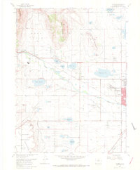
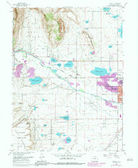
1968 Map of Hygiene
USGS Topo · Published 1968About this map
Hygiene sits at the center of an intricate hydraulic landscape where the waters of St Vrain Creek are diverted through a dense network of canals and reservoirs. This late 1960s survey captures the agricultural and industrial transition of the Boulder Valley, showing the growth of Longmont as it pushes westward toward McIntosh Lake. The reliance on irrigation is evident in the many named channels like the Oligarchy Ditch and Rough and Ready Ditch, which feed scattered water bodies such as Clover Basin Reservoir and Burch Lake. To the west, the landscape rises into prominent local landmarks including Rabbit Mountain and Table Top Mountain. The southwestern corner is defined by the technical infrastructure of the Antenna Field Sites and its associated Radio Telescopes, illustrating the area's role in scientific research and telecommunications.
Find a feature on this map
62 named features on this map. Tap any name to fly to it.
Don’t see what you’re looking for? This feature index may not catch every label — zoom into the map to look around manually.
Map Details
Editions of this 1968 Hygiene Map
5 editions found
Other maps of this area

1902 · Boulder
USGS Topo · 1:62,500

1904 · Niwot
USGS Topo · 1:62,500

1904 · Boulder
USGS Topo · 1:62,500

1905 · Mount Olympus
USGS Topo · 1:62,500

1906 · Loveland
USGS Topo · 1:62,500

1907 · Mount Olympus
USGS Topo · 1:62,500

1908 · Loveland
USGS Topo · 1:62,500

1950 · Hygiene
USGS Topo · 1:24,000
1950 · Erie
USGS Topo · 1:24,000

1950 · Niwot
USGS Topo · 1:24,000