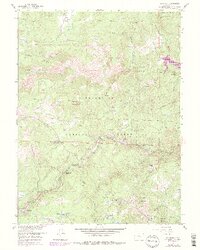
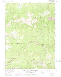
1957 Map of Raymond
USGS Topo · Published 1978About this map
Roosevelt National Forest surrounds a network of drainages where the North, Middle, and South forks of St Vrain Creek converge. The landscape is defined by its mid-century transition from a mining-dominated economy to one of seasonal recreation and ranching. Genealogists and local historians can locate several legacy sites, including the Bunce Sch (Aiken) and the historic footprint of Big Elk Ranch. Former mining operations like the Argo Mine and Burlington Mine are noted, alongside abandoned townsite locations at Balarat and Gresham.
Find a feature on this map
49 named features on this map. Tap any name to fly to it.
Don’t see what you’re looking for? This feature index may not catch every label — zoom into the map to look around manually.
Map Details
Editions of this 1957 Raymond Map
6 editions found
Other maps of this area

1902 · Boulder
USGS Topo · 1:62,500

1904 · Boulder
USGS Topo · 1:62,500

1905 · Mount Olympus
USGS Topo · 1:62,500

1907 · Mount Olympus
USGS Topo · 1:62,500

1915 · Longs Peak
USGS Topo · 1:125,000

1919 · Rocky Mountain National Park
USGS Topo · 1:125,000

1954 · Greeley
USGS Topo · 1:250,000

1957 · Greeley
USGS Topo · 1:250,000
1957 · Boulder
USGS Topo · 1:24,000

1957 · Allens Park
USGS Topo · 1:24,000