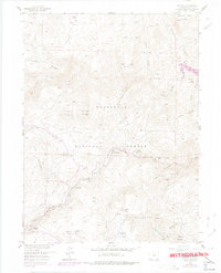
1957 Map of Raymond
USGS Topo · Published 1978About this map
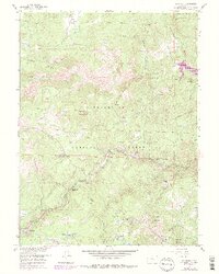
Riverside and Raymond occupy the narrow corridors where the Middle St Vrain Creek and South St Vrain Creek converge, illustrating the high-altitude settlement patterns of the Front Range. While modern recreation is centered at Glacier View Camp and Peaceful Valley, this survey documents the fading remnants of earlier eras. The abandoned Bunce Sch and the former townsite at Gresham (Site) suggest a more permanent local population during the early twentieth century than today's seasonal character. Mining activity is concentrated in the southeast, where the Argo Mine, Burlington Mine, and Emmett Mine are clustered near Balarat (Site). The terrain is defined by steep ridges like Ironclads and summits such as North Sheep Mountain, with the Button Rock Reservoir marking a significant man-made alteration to the drainage of North St Vrain Creek within the Roosevelt National Forest.
Find a feature on this map
48 named features on this map. Tap any name to fly to it.
Don’t see what you’re looking for? This feature index may not catch every label — zoom into the map to look around manually.
Map Details
Editions of this 1957 Raymond Map
6 editions found
Other maps of this area

1902 · Boulder
USGS Topo · 1:62,500

1904 · Boulder
USGS Topo · 1:62,500

1905 · Mount Olympus
USGS Topo · 1:62,500

1907 · Mount Olympus
USGS Topo · 1:62,500

1915 · Longs Peak
USGS Topo · 1:125,000

1919 · Rocky Mountain National Park
USGS Topo · 1:125,000

1954 · Greeley
USGS Topo · 1:250,000

1957 · Greeley
USGS Topo · 1:250,000
1957 · Boulder
USGS Topo · 1:24,000

1957 · Allens Park
USGS Topo · 1:24,000