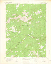
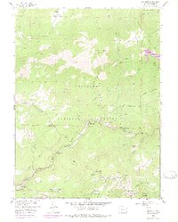
1957 Map of Raymond
USGS Topo · Published 1962About this map
Roosevelt National Forest dominates this mid-century landscape in the Colorado mountains, where the convergence of the North, Middle, and South St Vrain Creeks defines the local geography. Small settlements and mountain retreats like Peaceful Valley, Raymond, and Riverside are clustered along these narrow river valleys, illustrating a pattern of development dictated by the steep terrain of North Sheep Mountain and Taylor Mountain.
Find a feature on this map
47 named features on this map. Tap any name to fly to it.
Don’t see what you’re looking for? This feature index may not catch every label — zoom into the map to look around manually.
Map Details
Editions of this 1957 Raymond Map
6 editions found
Other maps of this area

1902 · Boulder
USGS Topo · 1:62,500

1904 · Boulder
USGS Topo · 1:62,500

1905 · Mount Olympus
USGS Topo · 1:62,500

1907 · Mount Olympus
USGS Topo · 1:62,500

1915 · Longs Peak
USGS Topo · 1:125,000

1919 · Rocky Mountain National Park
USGS Topo · 1:125,000

1954 · Greeley
USGS Topo · 1:250,000

1957 · Greeley
USGS Topo · 1:250,000
1957 · Boulder
USGS Topo · 1:24,000

1957 · Allens Park
USGS Topo · 1:24,000