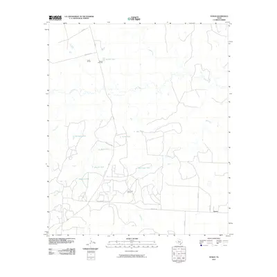
2010 Map of Hyman
USGS Topo · Published 2010About this map
The small settlement of Hyman anchors this West Texas landscape, which is defined by its industrial energy footprint and water management infrastructure. Located at the intersection of Co RD 359 and Ranch Rd 2183, the area is heavily marked by energy production at the Snyder Oil Field and the Hyman Scott Oil Field. The terrain is characterized by intermittent drainage systems including Beals Creek and Bull Creek, with numerous stock tanks such as Magnolia Tank and Scout Tank scattered across the quadrangle. In the north, Rankin Lake and the Rankin Lake Dam provide a more substantial water feature amidst the arid surroundings. This map illustrates the intersection of rural ranching needs and the sprawling infrastructure of the Texas oil industry in the early 21st century.
Find a feature on this map
26 named features on this map. Tap any name to fly to it.
Don’t see what you’re looking for? This feature index may not catch every label — zoom into the map to look around manually.
Map Details
Editions of this 2010 Hyman Map
This is the sole edition of this map. No revisions or reprints were ever made.
Other maps of this area

1941 · Big Spring South
USGS Topo · 1:62,500

1942 · Big Spring South
USGS Topo · 1:62,500

1942 · Big Spring North
USGS Topo · 1:62,500

1951 · Iatan
USGS Topo · 1:24,000

1952 · Iatan
USGS Topo · 1:24,000

1952 · Westbrook
USGS Topo · 1:24,000

1954 · Big Spring
USGS Topo · 1:250,000

1958 · Big Spring
USGS Topo · 1:250,000

1962 · Hyman NE
USGS Topo · 1:24,000

1963 · Buffalo Draw
USGS Topo · 1:24,000