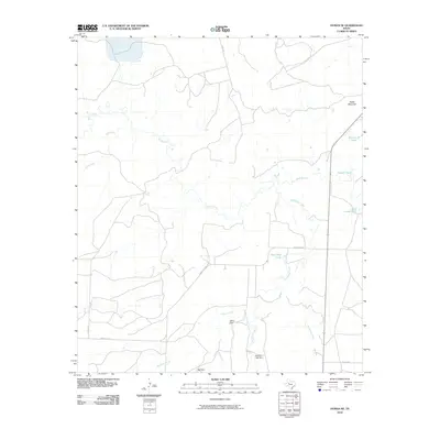
2010 Map of Hyman NE
USGS Topo · Published 2010About this map
Beals Mountain overlooks a landscape defined by an intricate network of intermittent drainages and ranching infrastructure in Mitchell County. The map reveals the hydrology of this semi-arid region, where Beals Creek is joined by tributaries such as Bull Creek and Hackberry Creek. Local land management is evident through numerous named water features, including Tom Neff Lake, Meteor Tank, and Vowell Tank, which supported the area's cattle operations and water conservation efforts in the early 21st century.
Find a feature on this map
18 named features on this map. Tap any name to fly to it.
Don’t see what you’re looking for? This feature index may not catch every label — zoom into the map to look around manually.
Map Details
Editions of this 2010 Hyman NE Map
This is the sole edition of this map. No revisions or reprints were ever made.
Other maps of this area

1950 · Lake Colorado City
USGS Topo · 1:24,000

1951 · Iatan
USGS Topo · 1:24,000

1952 · Iatan
USGS Topo · 1:24,000

1952 · Westbrook
USGS Topo · 1:24,000

1954 · Big Spring
USGS Topo · 1:250,000

1958 · Big Spring
USGS Topo · 1:250,000

1959 · Spade Ranch
USGS Topo · 1:24,000

1959 · McWhorter Mountain
USGS Topo · 1:24,000

1962 · Hyman NE
USGS Topo · 1:24,000

1963 · Buffalo Draw
USGS Topo · 1:24,000