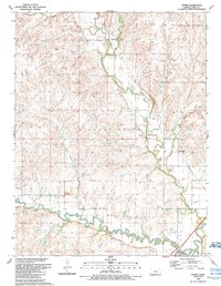
1989 Map of Hymer
USGS Topo · Published 1989About this map
The Cottonwood River and Middle Creek converge in the southern portion of this landscape, framing the small settlement of Elmdale. This late 1980s data reflects a geography defined by its watercourses and resource extraction, with an Oil and Gas Field and a separate Gas Field marking the upland sections. Smaller communities like Hymer and Rockland are connected by a network of drainage systems, including Diamond Creek and Schaffer Creek. For genealogists and local historians, the location of the Elmdale Cem and various unnamed quarries and a Gravel Pit provide specific points of interest for land use and family ties in the region. The map also traces modern infrastructure, such as a major Pipeline cutting through the terrain near Neva, showing the layer of industrial utility over the rural Kansas drainage basin.
Find a feature on this map
18 named features on this map. Tap any name to fly to it.
Don’t see what you’re looking for? This feature index may not catch every label — zoom into the map to look around manually.
Map Details
Editions of this 1989 Hymer Map
This is the sole edition of this map. No revisions or reprints were ever made.
Other maps of this area

1889 · Parkerville
USGS Topo · 1:125,000

1894 · Parkerville
USGS Topo · 1:125,000

1898 · Cottonwood Falls
USGS Topo · 1:125,000

1955 · Hutchinson
USGS Topo · 1:250,000

1957 · Elmdale
USGS Topo · 1:24,000

1957 · Strong City
USGS Topo · 1:24,000

1957 · Cedar Point
USGS Topo · 1:24,000

1957 · Hymer
USGS Topo · 1:24,000

1959 · Hutchinson
USGS Topo · 1:250,000

1970 · Lincolnville NE
USGS Topo · 1:24,000