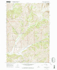
1967 Map of Hyndman Peak
USGS Topo · Published 1971About this map
Hyndman Peak and the surrounding high country of the Pioneer Mts dominate this mid-century survey of the Sawtooth National Forest. The map documents a landscape defined by its alpine topography and early resource extraction, marked by the Lucky G Mine and several other unnamed mine prospects. The East Fork Wood River carves through the southern portion of the quadrangle, where established recreation sites like the Hyndman Campground and Federal Gulch Campground appear alongside a network of backcountry routes. Higher elevations feature the Pioneer Cabin and a system of primitive paths including the Pack Trail and Federal Gulch Trail, which provided access to remote drainages such as Bear Gulch and Paymaster Gulch during this era of Idaho's forest management.
Find a feature on this map
44 named features on this map. Tap any name to fly to it.
Don’t see what you’re looking for? This feature index may not catch every label — zoom into the map to look around manually.
Map Details
Editions of this 1967 Hyndman Peak Map
2 editions found
Other maps of this area

1895 · Hailey
USGS Topo · 1:125,000

1897 · Hailey
USGS Topo · 1:125,000

1955 · Hailey
USGS Topo · 1:250,000

1959 · Hailey
USGS Topo · 1:250,000

1962 · Hailey
USGS Topo · 1:250,000

1967 · Rock Roll Canyon
USGS Topo · 1:24,000

1967 · Baugh Creek SW
USGS Topo · 1:24,000

1967 · Baugh Creek
USGS Topo · 1:24,000

1967 · Sun Valley
USGS Topo · 1:24,000
1967 · Grays Peak
USGS Topo · 1:24,000