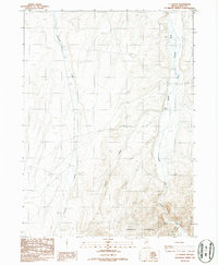
1987 Map of I L Ranch
USGS Topo · Published 1987About this map
The I L Ranch serves as the central namesake for this high-desert region in Elko County, situated along the South Fork Owyhee River. This 1987 provisional survey illustrates a remote ranching landscape where infrastructure is sparse, characterized by a Landing Strip and a single Gravel Pit providing the primary evidence of modern activity. The geography is defined by the southern reaches of the Tuscarora Mountains to the south and a network of drainages including Fourmile Creek, Amazon Creek, and Red Cow Creek that feed into the river system. The map reflects a late-20th-century view of Nevada's interior ranching culture, where large landholdings are anchored by seasonal water sources and isolated airstrips rather than traditional township developments.
Find a feature on this map
8 named features on this map. Tap any name to fly to it.
Don’t see what you’re looking for? This feature index may not catch every label — zoom into the map to look around manually.
Map Details
Editions of this 1987 I L Ranch Map
This is the sole edition of this map. No revisions or reprints were ever made.
Other maps of this area

1955 · McDermitt
USGS Topo · 1:250,000

1956 · Mt. Blitzen
USGS Topo · 1:62,500

1959 · McDermitt
USGS Topo · 1:250,000

1964 · Wilson Reservoir
USGS Topo · 1:62,500

1974 · Soldier Cap
USGS Topo · 1:24,000

1974 · Middle Draw Reservoir
USGS Topo · 1:24,000

1974 · Desert Ranch
USGS Topo · 1:24,000

1982 · Bull Run Mts
USGS Topo · 1:100,000

1982 · Tuscarora
USGS Topo · 1:100,000
1987 · Fourmile Butte
USGS Topo · 1:24,000