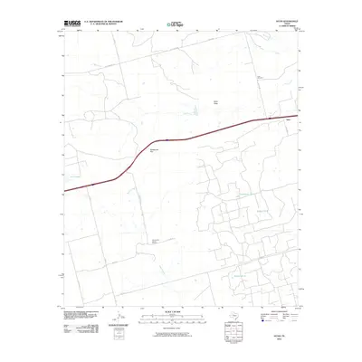
2010 Map of Iatan
USGS Topo · Published 2010About this map
Iatan occupies a subtle rise in the West Texas landscape, serving as a primary landmark in a region defined by its wide, open drainages and energy production. The East Howard County Oil Field dominates the southern portion of the quadrangle, reflecting the industrial character of the plains where local resource extraction and ranching intersect. Water management is central to the area's geography, evidenced by man-made catchments like California Tank, Willow Tank, and Watson Tank which dot the terrain alongside more seasonal features like Iatan Creek and Iatan Lake.
Find a feature on this map
25 named features on this map. Tap any name to fly to it.
Don’t see what you’re looking for? This feature index may not catch every label — zoom into the map to look around manually.
Map Details
Editions of this 2010 Iatan Map
This is the sole edition of this map. No revisions or reprints were ever made.
Other maps of this area

1941 · Big Spring South
USGS Topo · 1:62,500

1942 · Big Spring South
USGS Topo · 1:62,500

1942 · Big Spring North
USGS Topo · 1:62,500

1951 · Vincent
USGS Topo · 1:24,000

1951 · Iatan
USGS Topo · 1:24,000

1952 · Iatan
USGS Topo · 1:24,000

1952 · Cuthbert
USGS Topo · 1:24,000

1952 · Westbrook
USGS Topo · 1:24,000

1954 · Big Spring
USGS Topo · 1:250,000

1954 · Big Spring North NE
USGS Topo · 1:24,000