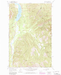
1966 Map of Ibex Peak
USGS Topo · Published 1984About this map
Cabinet Mountains dominate the eastern reaches of this mountain landscape, which sits at the intersection of the Kootenai National Forest and Kaniksu National Forest. The dramatic transition from the high peaks down to the Bull River valley is the defining geographic feature, with the waters of Bull Lake filling the northern portion of the glacial trench. This 1960s survey, updated in the 1980s, highlights a wilderness character defined by access rather than settlement, showing a network of pack trails and drainage-fed gulches like Baker Gulch and Hamilton Gulch.
Find a feature on this map
30 named features on this map. Tap any name to fly to it.
Don’t see what you’re looking for? This feature index may not catch every label — zoom into the map to look around manually.
Map Details
Editions of this 1966 Ibex Peak Map
2 editions found
Other maps of this area

1920 · Libby
USGS Topo · 1:125,000

1930 · Libby
USGS Topo · 1:125,000

1932 · Libby
USGS Topo · 1:125,000

1957 · Kalispell
USGS Topo · 1:250,000

1960 · Kalispell
USGS Topo · 1:250,000

1961 · Kalispell
USGS Topo · 1:250,000
1963 · Spar Lake
USGS Topo · 1:24,000

1963 · Treasure Mountain
USGS Topo · 1:24,000
1963 · Crowell Mountain
USGS Topo · 1:24,000
1966 · Ibex Peak
USGS Topo · 1:24,000