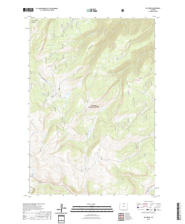
2021 Map of Ice Creek
USGS Topo · Published 2021About this map
Bighorn National Forest defines the character of this high-elevation landscape, where the headwaters of several key drainages converge near the boundary of Big Horn and Sheridan Counties. The terrain is deeply dissected by numerous watercourses, including the N Tongue River in the south and the Little Bighorn Valley in the northwest. The drainage patterns of Fishhook Cr and Hideout Cr illustrate the complex watershed that feeds into larger regional river systems.
Find a feature on this map
23 named features on this map. Tap any name to fly to it.
Don’t see what you’re looking for? This feature index may not catch every label — zoom into the map to look around manually.
Map Details
Editions of this 2021 Ice Creek Map
This is the sole edition of this map. No revisions or reprints were ever made.
Other maps of this area

1898 · Bald Mountain
USGS Topo · 1:125,000

1901 · Bald Mountain
USGS Topo · 1:125,000

1955 · Sheridan
USGS Topo · 1:250,000

1958 · Sheridan
USGS Topo · 1:250,000

1960 · Boyd Ridge
USGS Topo · 1:24,000

1960 · Granite Pass
USGS Topo · 1:24,000

1960 · Hidden Tepee Creek
USGS Topo · 1:24,000
1960 · Bald Mountain
USGS Topo · 1:24,000
1960 · Leavitt Reservoir
USGS Topo · 1:24,000

1962 · Sheridan
USGS Topo · 1:250,000