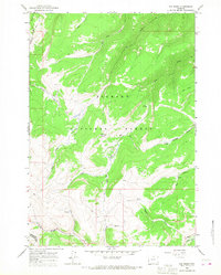
1964 Map of Ice Creek
USGS Topo · Published 1968About this map
Bighorn National Forest dominates this mid-1960s landscape, where the high-altitude hydrology of the Tongue River watershed is meticulously documented. The terrain is a network of drainage systems, including the complex tributaries of Ice Creek, Fishhook Creek, and Lake Creek. One of the few human developments noted in this remote area is the Kane Cow Camp, situated near a series of unnamed Springs.
Find a feature on this map
24 named features on this map. Tap any name to fly to it.
Don’t see what you’re looking for? This feature index may not catch every label — zoom into the map to look around manually.
Map Details
Editions of this 1964 Ice Creek Map
This is the sole edition of this map. No revisions or reprints were ever made.
Other maps of this area

1898 · Bald Mountain
USGS Topo · 1:125,000

1901 · Bald Mountain
USGS Topo · 1:125,000

1955 · Sheridan
USGS Topo · 1:250,000

1958 · Sheridan
USGS Topo · 1:250,000

1960 · Boyd Ridge
USGS Topo · 1:24,000

1960 · Granite Pass
USGS Topo · 1:24,000

1960 · Hidden Tepee Creek
USGS Topo · 1:24,000
1960 · Bald Mountain
USGS Topo · 1:24,000
1960 · Leavitt Reservoir
USGS Topo · 1:24,000

1962 · Sheridan
USGS Topo · 1:250,000