
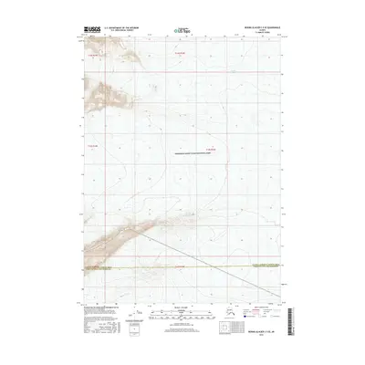
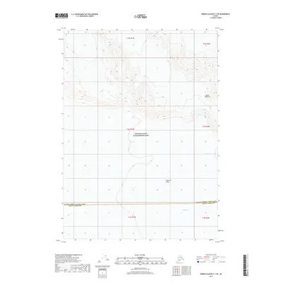
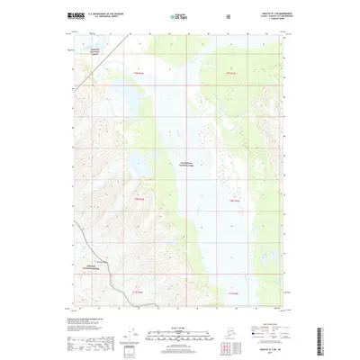
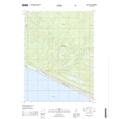
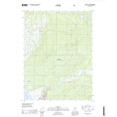
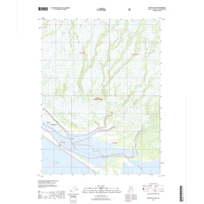
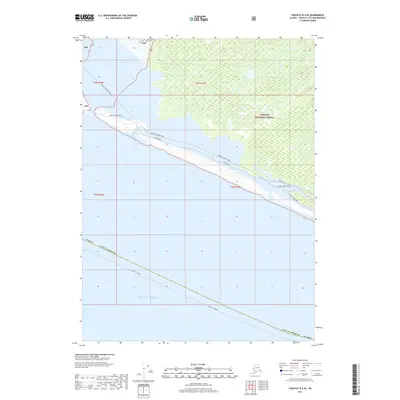
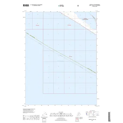
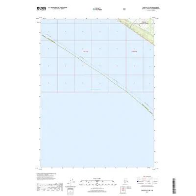
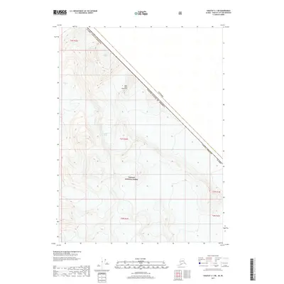
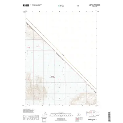
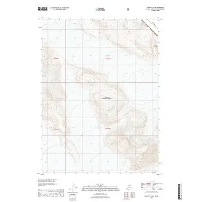
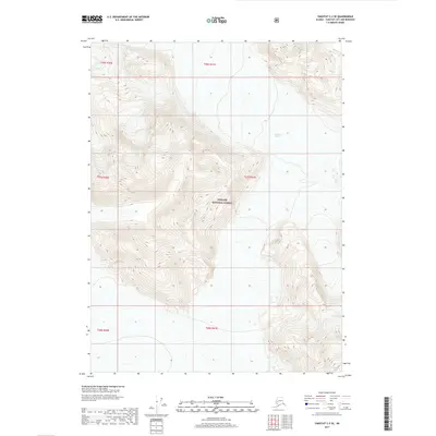
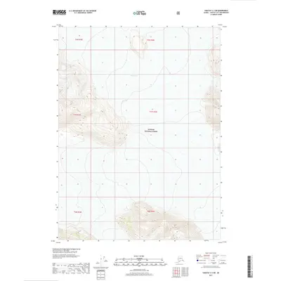
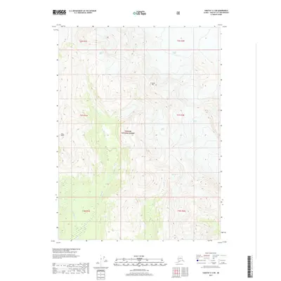
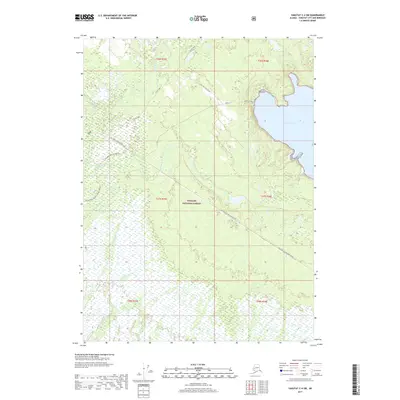
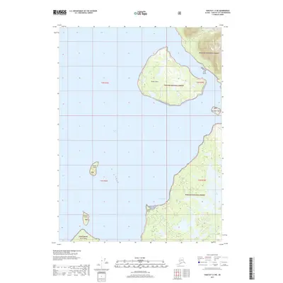
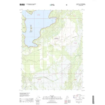
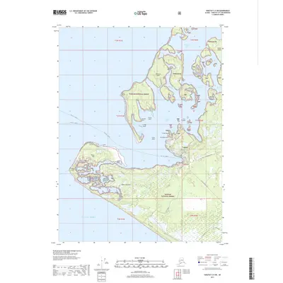
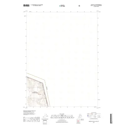
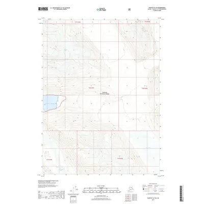
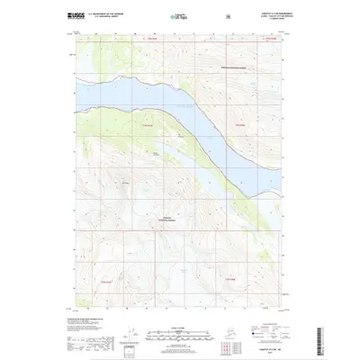
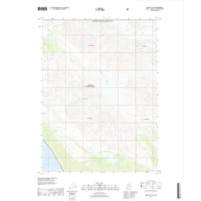
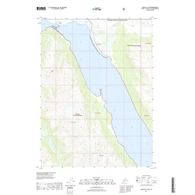
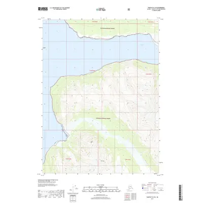
1959 Map of Icy Bay D-2 and D-3
USGS Topo · Published 1986About this map
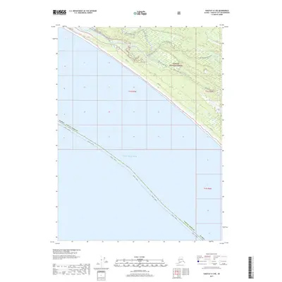
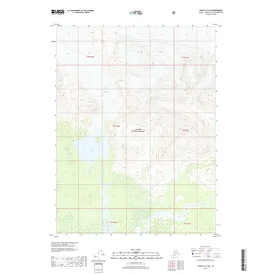
Guyot Bay and the shoreline of Icy Bay define this mid-century view of the Alaskan coast near Icy Cape. The map documents a dynamic landscape where the Gulf of Alaska meets a network of glacial rivers and coastal features, including the Yahtse River and Big River. Remote infrastructure is represented by a Landing Strip situated near Priest River, reflecting the era's reliance on bush aviation for coastal access. To the east, the Riou Bay area contains distinctive geographical markers like Point Riou Spit and the secluded Sacred Lake. The presence of Moraine Island and Moraine Reef highlights the visible impact of glacial movement on the coastal topography, providing a detailed record of the shoreline before the minor revisions of the early 1980s.
Find a feature on this map
22 named features on this map. Tap any name to fly to it.
Don’t see what you’re looking for? This feature index may not catch every label — zoom into the map to look around manually.
Map Details
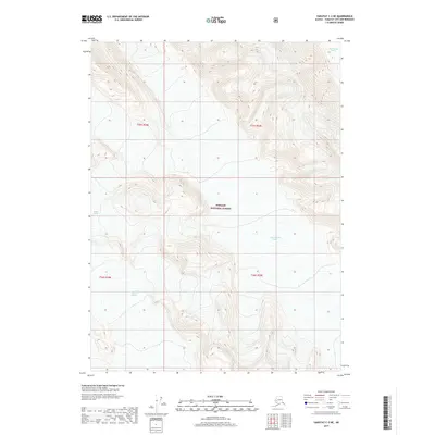
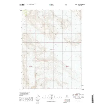
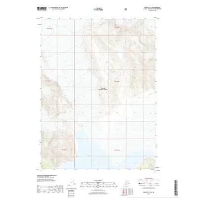
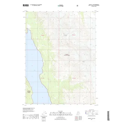
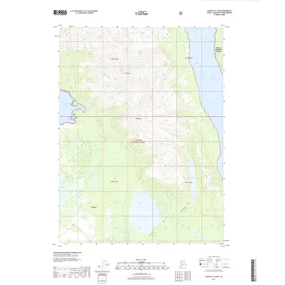
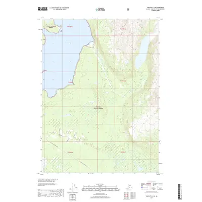
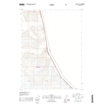
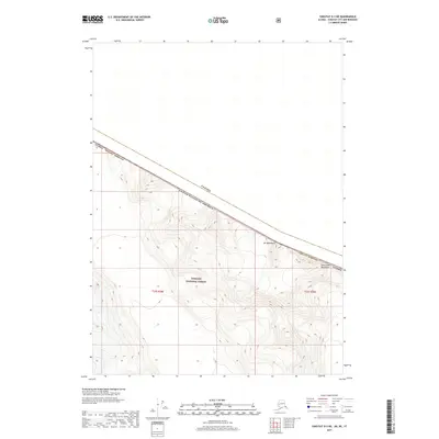
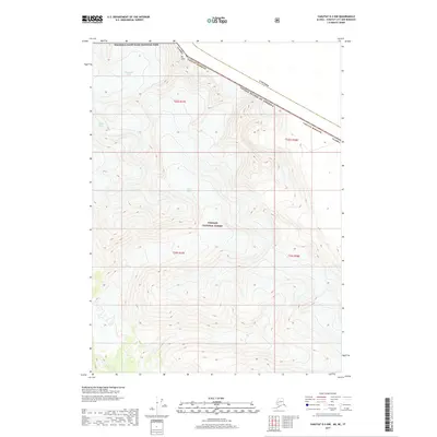
Editions of this 1959 Icy Bay D-2 and D-3 Map
3 editions found
Historical Maps of Yakutat Through Time
343 maps found

1948 Bering Glacier A-4
Yakutat Borough, AK

1948 Icy Bay D-2 and D-3
Yakutat Borough, AK

1950 Bering Glacier A-3
Yakutat Borough, AK

1950 Bering Glacier
Yakutat Borough, AK

1950 Icy Bay
Yakutat Borough, AK

1951 Bering Glacier A-2
Yakutat Borough, AK

1951 Bering Glacier A-4
Yakutat Borough, AK

1951 Bering Glacier
Yakutat Borough, AK

1951 Icy Bay D-2 and D-3
Yakutat Borough, AK

1951 Icy Bay
Yakutat Borough, AK

1951 Mt Saint Elias
Yakutat Borough, AK

1959 Bering Glacier A-2
Yakutat Borough, AK

1959 Bering Glacier A-3
Yakutat Borough, AK

1959 Bering Glacier A-4
Yakutat Borough, AK

1959 Bering Glacier
Yakutat Borough, AK
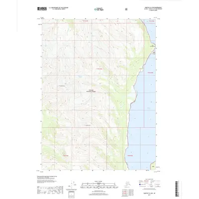
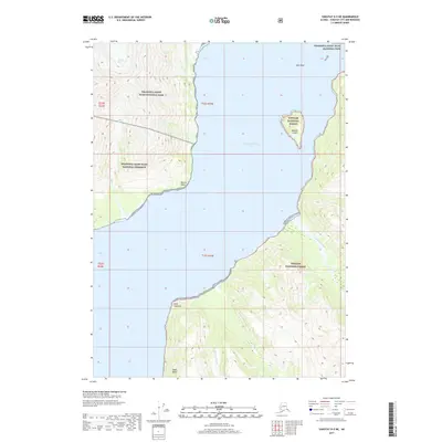
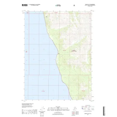
1959 Icy Bay D-2 and D-3
Yakutat Borough, AK

1959 Mt Saint Elias
Yakutat Borough, AK

1959 Yakutat A-1
Yakutat Borough, AK

1959 Yakutat A-2
Yakutat Borough, AK

1959 Yakutat A-3
Yakutat Borough, AK

1959 Yakutat B-1
Yakutat Borough, AK

1959 Yakutat B-2
Yakutat Borough, AK

1959 Yakutat B-3
Yakutat Borough, AK

1959 Yakutat B-4
Yakutat Borough, AK

1959 Yakutat B-5
Yakutat Borough, AK

1959 Yakutat C-3
Yakutat Borough, AK

1959 Yakutat C-4
Yakutat Borough, AK

1959 Yakutat C-5
Yakutat Borough, AK

1959 Yakutat D-3
Yakutat Borough, AK

1959 Yakutat D-4
Yakutat Borough, AK

1959 Yakutat D-5
Yakutat Borough, AK

1961 Icy Bay
Yakutat Borough, AK

1961 Mount Fairweather D-6
Yakutat Borough, AK

1961 Mount Fairweather D-7
Yakutat Borough, AK

1961 Skagway A-7
Yakutat Borough, AK

1961 Skagway A-8
Yakutat Borough, AK

1961 Skagway B-8
Yakutat Borough, AK

1984 Bering Glacier A-4
Yakutat Borough, AK

1984 Bering Glacier A-5
Yakutat Borough, AK

1984 Bering Glacier A-6
Yakutat Borough, AK

1984 Bering Glacier A-7
Yakutat Borough, AK

1984 Bering Glacier A-8
Yakutat Borough, AK

1985 Bering Glacier A-1
Yakutat Borough, AK

1985 Bering Glacier B-1
Yakutat Borough, AK

1985 Bering Glacier B-2
Yakutat Borough, AK

1985 Bering Glacier B-3
Yakutat Borough, AK

1985 Bering Glacier B-4
Yakutat Borough, AK

1985 Bering Glacier B-5
Yakutat Borough, AK

1985 Bering Glacier B-6
Yakutat Borough, AK

1985 Bering Glacier B-7
Yakutat Borough, AK

1985 Bering Glacier C-3
Yakutat Borough, AK

1985 Bering Glacier C-4
Yakutat Borough, AK

1985 Bering Glacier C-5
Yakutat Borough, AK

1985 Bering Glacier C-6
Yakutat Borough, AK

1985 Icy Bay D-1
Yakutat Borough, AK

1985 Mount Saint Elias A-3
Yakutat Borough, AK

1985 Mount Saint Elias A-4
Yakutat Borough, AK

1985 Mount Saint Elias A-5
Yakutat Borough, AK

1985 Mount Saint Elias A-6
Yakutat Borough, AK

1985 Mount Saint Elias A-7
Yakutat Borough, AK

1985 Mount Saint Elias A-8
Yakutat Borough, AK

1985 Mount Saint Elias B-3
Yakutat Borough, AK

1985 Mount Saint Elias B-4
Yakutat Borough, AK

1985 Mount Saint Elias B-5
Yakutat Borough, AK

1985 Mount Saint Elias B-7
Yakutat Borough, AK

1985 Mount Saint Elias B-8
Yakutat Borough, AK

1985 Yakutat C-1
Yakutat Borough, AK

1985 Yakutat C-2
Yakutat Borough, AK

1985 Yakutat C-6
Yakutat Borough, AK

1985 Yakutat C-7
Yakutat Borough, AK

1985 Yakutat C-8
Yakutat Borough, AK

1985 Yakutat D-2
Yakutat Borough, AK

1985 Yakutat D-6
Yakutat Borough, AK

1985 Yakutat D-7
Yakutat Borough, AK

1985 Yakutat D-8
Yakutat Borough, AK

1987 Yakutat B-4 NW
Yakutat Borough, AK

1987 Yakutat B-5 NE
Yakutat Borough, AK

1987 Yakutat C-4 SE
Yakutat Borough, AK

1987 Yakutat C-4 SW
Yakutat Borough, AK

1987 Yakutat C-5 SE
Yakutat Borough, AK

1987 Yakutat C-5 SW
Yakutat Borough, AK

1996 Yakutat C-5
Yakutat Borough, AK

1997 Yakutat B-1
Yakutat Borough, AK

1997 Yakutat C-4
Yakutat Borough, AK

2014 Bering Glacier A-8 NE
Yakutat Borough, AK

2014 Bering Glacier A-8 OE S NW
Yakutat Borough, AK

2014 Bering Glacier A-8 SE
Yakutat Borough, AK

2014 Bering Glacier A-8 SW
Yakutat Borough, AK

2014 Bering Glacier B-6 NW
Yakutat Borough, AK

2014 Bering Glacier B-7 NE
Yakutat Borough, AK

2014 Bering Glacier C-6 SW
Yakutat Borough, AK

2016 Bering Glacier A-4 NE
Yakutat Borough, AK

2016 Bering Glacier A-4 NW
Yakutat Borough, AK

2016 Bering Glacier A-4 SE
Yakutat Borough, AK

2016 Bering Glacier A-4 SW
Yakutat Borough, AK

2016 Bering Glacier A-5 NE
Yakutat Borough, AK

2016 Bering Glacier A-5 NW
Yakutat Borough, AK

2016 Bering Glacier A-5 SE
Yakutat Borough, AK

2016 Bering Glacier A-5 SW
Yakutat Borough, AK

2016 Bering Glacier A-6 NE
Yakutat Borough, AK

2016 Bering Glacier A-6 NW
Yakutat Borough, AK

2016 Bering Glacier A-6 SE
Yakutat Borough, AK

2016 Bering Glacier A-6 SW
Yakutat Borough, AK

2016 Bering Glacier A-7 NE
Yakutat Borough, AK

2016 Bering Glacier A-7 NW
Yakutat Borough, AK

2016 Bering Glacier A-7 SE
Yakutat Borough, AK

2016 Bering Glacier A-7 SW
Yakutat Borough, AK

2016 Bering Glacier B-4 NE
Yakutat Borough, AK

2016 Bering Glacier B-4 NW
Yakutat Borough, AK

2016 Bering Glacier B-4 SE
Yakutat Borough, AK

2016 Bering Glacier B-4 SW
Yakutat Borough, AK

2016 Bering Glacier B-5 NE
Yakutat Borough, AK

2016 Bering Glacier B-5 NW
Yakutat Borough, AK

2016 Bering Glacier B-5 SE
Yakutat Borough, AK

2016 Bering Glacier B-5 SW
Yakutat Borough, AK

2016 Bering Glacier B-6 NE
Yakutat Borough, AK

2016 Bering Glacier B-6 SE
Yakutat Borough, AK

2016 Bering Glacier B-6 SW
Yakutat Borough, AK

2016 Bering Glacier B-7 SE
Yakutat Borough, AK

2016 Bering Glacier B-7 SW
Yakutat Borough, AK
2016 Bering Glacier C-4 SE
Yakutat Borough, AK
2016 Bering Glacier C-4 SW
Yakutat Borough, AK
2016 Bering Glacier C-5 SE
Yakutat Borough, AK
2016 Bering Glacier C-5 SW
Yakutat Borough, AK
2016 Bering Glacier C-6 SE
Yakutat Borough, AK

2017 Bering Glacier A-1 NE
Yakutat Borough, AK

2017 Bering Glacier A-1 NW
Yakutat Borough, AK

2017 Bering Glacier A-1 SE
Yakutat Borough, AK

2017 Bering Glacier A-1 SW
Yakutat Borough, AK

2017 Bering Glacier A-2 NE
Yakutat Borough, AK

2017 Bering Glacier A-2 NW
Yakutat Borough, AK

2017 Bering Glacier A-2 SE
Yakutat Borough, AK

2017 Bering Glacier A-2 SW
Yakutat Borough, AK

2017 Bering Glacier A-3 NE
Yakutat Borough, AK

2017 Bering Glacier A-3 NW
Yakutat Borough, AK

2017 Bering Glacier A-3 SE
Yakutat Borough, AK

2017 Bering Glacier A-3 SW
Yakutat Borough, AK

2017 Bering Glacier B-1 NE
Yakutat Borough, AK

2017 Bering Glacier B-1 NW
Yakutat Borough, AK

2017 Bering Glacier B-1 SE
Yakutat Borough, AK

2017 Bering Glacier B-1 SW
Yakutat Borough, AK

2017 Bering Glacier B-2 NE
Yakutat Borough, AK

2017 Bering Glacier B-2 NW
Yakutat Borough, AK

2017 Bering Glacier B-2 SE
Yakutat Borough, AK

2017 Bering Glacier B-2 SW
Yakutat Borough, AK

2017 Bering Glacier B-3 NE
Yakutat Borough, AK

2017 Bering Glacier B-3 NW
Yakutat Borough, AK

2017 Bering Glacier B-3 SE
Yakutat Borough, AK

2017 Bering Glacier B-3 SW
Yakutat Borough, AK
2017 Bering Glacier C-3 SE
Yakutat Borough, AK
2017 Bering Glacier C-3 SW
Yakutat Borough, AK

2017 Icy Bay D-1 NE
Yakutat Borough, AK

2017 Icy Bay D-1 NW
Yakutat Borough, AK

2017 Icy Bay D-1 SE
Yakutat Borough, AK

2017 Icy Bay D-1 SW
Yakutat Borough, AK

2017 Icy Bay D-2 NE
Yakutat Borough, AK

2017 Icy Bay D-2 NW
Yakutat Borough, AK

2017 Icy Bay D-2 SE
Yakutat Borough, AK

2017 Icy Bay D-3 NE
Yakutat Borough, AK

2017 Mount Fairweather D-5 NW
Yakutat Borough, AK

2017 Mount Fairweather D-6 NE
Yakutat Borough, AK

2017 Mount Fairweather D-6 NW
Yakutat Borough, AK

2017 Mount Fairweather D-6 SW
Yakutat Borough, AK

2017 Mount Fairweather D-7 NE
Yakutat Borough, AK

2017 Mount Saint Elias A-4 NE
Yakutat Borough, AK

2017 Mount Saint Elias A-4 NW
Yakutat Borough, AK

2017 Mount Saint Elias A-4 SE
Yakutat Borough, AK

2017 Mount Saint Elias A-4 SW
Yakutat Borough, AK

2017 Mount Saint Elias A-5 NE
Yakutat Borough, AK

2017 Mount Saint Elias A-5 NW
Yakutat Borough, AK

2017 Mount Saint Elias A-5 SE
Yakutat Borough, AK

2017 Mount Saint Elias A-5 SW
Yakutat Borough, AK

2017 Mount Saint Elias A-6 NE
Yakutat Borough, AK

2017 Mount Saint Elias A-6 NW
Yakutat Borough, AK

2017 Mount Saint Elias A-6 SE
Yakutat Borough, AK

2017 Mount Saint Elias A-6 SW
Yakutat Borough, AK

2017 Mount Saint Elias A-7 NE
Yakutat Borough, AK

2017 Mount Saint Elias A-7 NW
Yakutat Borough, AK

2017 Mount Saint Elias A-7 SE
Yakutat Borough, AK

2017 Mount Saint Elias A-7 SW
Yakutat Borough, AK

2017 Mount Saint Elias A-8 NE
Yakutat Borough, AK

2017 Mount Saint Elias A-8 NW
Yakutat Borough, AK

2017 Mount Saint Elias A-8 SE
Yakutat Borough, AK

2017 Mount Saint Elias A-8 SW
Yakutat Borough, AK

2017 Mount Saint Elias B-4 SE
Yakutat Borough, AK

2017 Mount Saint Elias B-4 SW
Yakutat Borough, AK

2017 Mount Saint Elias B-5 SE
Yakutat Borough, AK

2017 Mount Saint Elias B-5 SW
Yakutat Borough, AK

2017 Mount Saint Elias B-7 OE E SW
Yakutat Borough, AK

2017 Mount Saint Elias B-7 SE
Yakutat Borough, AK

2017 Mount Saint Elias B-7 SW
Yakutat Borough, AK

2017 Mount Saint Elias B-8 SE
Yakutat Borough, AK

2017 Mount Saint Elias B-8 SW
Yakutat Borough, AK

2017 Yakutat A-1 NE
Yakutat Borough, AK
2017 Yakutat A-1 NW
Yakutat Borough, AK

2017 Yakutat A-1 SE
Yakutat Borough, AK

2017 Yakutat A-1 SW
Yakutat Borough, AK
2017 Yakutat A-2 NE
Yakutat Borough, AK
2017 Yakutat A-2 NW
Yakutat Borough, AK

2017 Yakutat A-2 SE
Yakutat Borough, AK
2017 Yakutat A-2 SW
Yakutat Borough, AK
2017 Yakutat A-3 NE
Yakutat Borough, AK
2017 Yakutat B-1 NE
Yakutat Borough, AK
2017 Yakutat B-1 NW
Yakutat Borough, AK

2017 Yakutat B-1 SE
Yakutat Borough, AK
2017 Yakutat B-1 SW
Yakutat Borough, AK
2017 Yakutat B-2 NE
Yakutat Borough, AK
2017 Yakutat B-2 NW
Yakutat Borough, AK
2017 Yakutat B-2 SE
Yakutat Borough, AK
2017 Yakutat B-2 SW
Yakutat Borough, AK
2017 Yakutat B-3 NE
Yakutat Borough, AK
2017 Yakutat B-3 NW
Yakutat Borough, AK
2017 Yakutat B-3 SE
Yakutat Borough, AK
2017 Yakutat B-3 SW
Yakutat Borough, AK
2017 Yakutat B-4 NE
Yakutat Borough, AK
2017 Yakutat B-4 NW
Yakutat Borough, AK
2017 Yakutat B-4 SE
Yakutat Borough, AK
2017 Yakutat B-4 SW
Yakutat Borough, AK

2017 Yakutat B-5 NE
Yakutat Borough, AK
2017 Yakutat B-5 NW
Yakutat Borough, AK
2017 Yakutat C-1 NW
Yakutat Borough, AK
2017 Yakutat C-1 SE
Yakutat Borough, AK
2017 Yakutat C-1 SW
Yakutat Borough, AK
2017 Yakutat C-2 NE
Yakutat Borough, AK
2017 Yakutat C-2 NW
Yakutat Borough, AK
2017 Yakutat C-2 SE
Yakutat Borough, AK
2017 Yakutat C-2 SW
Yakutat Borough, AK
2017 Yakutat C-3 NE
Yakutat Borough, AK
2017 Yakutat C-3 NW
Yakutat Borough, AK
2017 Yakutat C-3 SE
Yakutat Borough, AK
2017 Yakutat C-3 SW
Yakutat Borough, AK
2017 Yakutat C-4 NE
Yakutat Borough, AK
2017 Yakutat C-4 NW
Yakutat Borough, AK
2017 Yakutat C-4 SE
Yakutat Borough, AK
2017 Yakutat C-4 SW
Yakutat Borough, AK
2017 Yakutat C-5 NE
Yakutat Borough, AK
2017 Yakutat C-5 SE
Yakutat Borough, AK
2017 Yakutat C-5 SW
Yakutat Borough, AK

2017 Yakutat C-6 NW
Yakutat Borough, AK

2017 Yakutat C-7 NE
Yakutat Borough, AK

2017 Yakutat C-7 NW
Yakutat Borough, AK

2017 Yakutat C-8 NE
Yakutat Borough, AK

2017 Yakutat C-8 NW
Yakutat Borough, AK
2017 Yakutat D-2 NW
Yakutat Borough, AK
2017 Yakutat D-2 SW
Yakutat Borough, AK
2017 Yakutat D-3 NE
Yakutat Borough, AK
2017 Yakutat D-3 NW
Yakutat Borough, AK
2017 Yakutat D-3 SE
Yakutat Borough, AK
2017 Yakutat D-3 SW
Yakutat Borough, AK
2017 Yakutat D-4 NE
Yakutat Borough, AK
2017 Yakutat D-4 NW
Yakutat Borough, AK
2017 Yakutat D-4 SE
Yakutat Borough, AK
2017 Yakutat D-4 SW
Yakutat Borough, AK
2017 Yakutat D-5 NE
Yakutat Borough, AK

2017 Yakutat D-5 NW
Yakutat Borough, AK
2017 Yakutat D-5 SE
Yakutat Borough, AK

2017 Yakutat D-5 SW
Yakutat Borough, AK

2017 Yakutat D-6 NE
Yakutat Borough, AK

2017 Yakutat D-6 NW
Yakutat Borough, AK

2017 Yakutat D-6 SE
Yakutat Borough, AK

2017 Yakutat D-6 SW
Yakutat Borough, AK

2017 Yakutat D-7 NE
Yakutat Borough, AK

2017 Yakutat D-7 NW
Yakutat Borough, AK

2017 Yakutat D-7 SE
Yakutat Borough, AK

2017 Yakutat D-7 SW
Yakutat Borough, AK

2017 Yakutat D-8 NE
Yakutat Borough, AK

2017 Yakutat D-8 NW
Yakutat Borough, AK

2017 Yakutat D-8 SE
Yakutat Borough, AK

2017 Yakutat D-8 SW
Yakutat Borough, AK

2018 Bering Glacier A-8 OE S NE
Yakutat Borough, AK

2018 Mount Saint Elias A-3 NW
Yakutat Borough, AK

2018 Mount Saint Elias A-3 SW
Yakutat Borough, AK

2018 Mount Saint Elias B-3 SW
Yakutat Borough, AK

2018 Yakutat A-3 NW
Yakutat Borough, AK

2021 Skagway A-7 NW
Yakutat Borough, AK

2021 Skagway A-7 SW
Yakutat Borough, AK

2021 Skagway A-8 NE
Yakutat Borough, AK

2021 Skagway A-8 NW
Yakutat Borough, AK

2021 Skagway A-8 SE
Yakutat Borough, AK

2021 Skagway A-8 SW
Yakutat Borough, AK

2021 Skagway B-8 NW
Yakutat Borough, AK

2021 Skagway B-8 OE E SW
Yakutat Borough, AK

2021 Skagway B-8 SE
Yakutat Borough, AK

2021 Skagway B-8 SW
Yakutat Borough, AK

2021 Yakutat A-1 NW
Yakutat Borough, AK

2021 Yakutat A-2 NE
Yakutat Borough, AK

2021 Yakutat A-2 NW
Yakutat Borough, AK

2021 Yakutat A-2 SW
Yakutat Borough, AK

2021 Yakutat A-3 NE
Yakutat Borough, AK

2021 Yakutat B-1 NE
Yakutat Borough, AK

2021 Yakutat B-1 NW
Yakutat Borough, AK

2021 Yakutat B-1 SW
Yakutat Borough, AK

2021 Yakutat B-2 NE
Yakutat Borough, AK

2021 Yakutat B-2 NW
Yakutat Borough, AK

2021 Yakutat B-2 SE
Yakutat Borough, AK

2021 Yakutat B-2 SW
Yakutat Borough, AK

2021 Yakutat B-3 NE
Yakutat Borough, AK

2021 Yakutat B-3 NW
Yakutat Borough, AK

2021 Yakutat B-3 SE
Yakutat Borough, AK

2021 Yakutat B-3 SW
Yakutat Borough, AK

2021 Yakutat B-4 NE
Yakutat Borough, AK

2021 Yakutat B-4 NW
Yakutat Borough, AK

2021 Yakutat B-4 SE
Yakutat Borough, AK

2021 Yakutat B-4 SW
Yakutat Borough, AK

2021 Yakutat B-5 NE
Yakutat Borough, AK

2021 Yakutat B-5 NW
Yakutat Borough, AK

2021 Yakutat C-1 NW
Yakutat Borough, AK

2021 Yakutat C-1 SE
Yakutat Borough, AK

2021 Yakutat C-1 SW
Yakutat Borough, AK

2021 Yakutat C-2 NE
Yakutat Borough, AK

2021 Yakutat C-2 NW
Yakutat Borough, AK

2021 Yakutat C-2 SE
Yakutat Borough, AK

2021 Yakutat C-2 SW
Yakutat Borough, AK

2021 Yakutat C-3 NE
Yakutat Borough, AK

2021 Yakutat C-3 NW
Yakutat Borough, AK

2021 Yakutat C-3 SE
Yakutat Borough, AK

2021 Yakutat C-3 SW
Yakutat Borough, AK

2021 Yakutat C-4 NE
Yakutat Borough, AK

2021 Yakutat C-4 NW
Yakutat Borough, AK

2021 Yakutat C-4 SE
Yakutat Borough, AK

2021 Yakutat C-4 SW
Yakutat Borough, AK

2021 Yakutat C-5 NE
Yakutat Borough, AK

2021 Yakutat C-5 SE
Yakutat Borough, AK

2021 Yakutat C-5 SW
Yakutat Borough, AK

2021 Yakutat D-2 NW
Yakutat Borough, AK

2021 Yakutat D-2 SW
Yakutat Borough, AK

2021 Yakutat D-3 NE
Yakutat Borough, AK

2021 Yakutat D-3 NW
Yakutat Borough, AK

2021 Yakutat D-3 SE
Yakutat Borough, AK

2021 Yakutat D-3 SW
Yakutat Borough, AK

2021 Yakutat D-4 NE
Yakutat Borough, AK

2021 Yakutat D-4 NW
Yakutat Borough, AK

2021 Yakutat D-4 SE
Yakutat Borough, AK

2021 Yakutat D-4 SW
Yakutat Borough, AK

2021 Yakutat D-5 NE
Yakutat Borough, AK

2021 Yakutat D-5 SE
Yakutat Borough, AK

2024 Bering Glacier C-3 SE
Yakutat Borough, AK

2024 Bering Glacier C-3 SW
Yakutat Borough, AK

2024 Bering Glacier C-4 SE
Yakutat Borough, AK

2024 Bering Glacier C-4 SW
Yakutat Borough, AK

2024 Bering Glacier C-5 SE
Yakutat Borough, AK

2024 Bering Glacier C-5 SW
Yakutat Borough, AK

2024 Bering Glacier C-6 SE
Yakutat Borough, AK