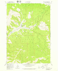
1957 Map of Idaho City
USGS Topo · Published 1979About this map
Idaho City serves as the focal point of this Boise Basin survey, showing the settlement's footprint during a period of forest management and early mid-century aviation. The landscape is heavily marked by its mining heritage, specifically at the Gold Hill Mine and the extensive tailings along Elk Creek. Cultural history is visible at the Boot Hill Cem and the Boise Basin Experiment Sta, reflecting the transition from the gold rush era to scientific forestry. The map documents a complex drainage system within the Boise National Forest, where steep gulches like Slaughterhouse Gulch and Coalpit Gulch feed into Mores Creek. A Landing Strip and the historic Spanish Trail highlight the evolution of transportation in this steep Idaho terrain, while various water sources such as Warm Springs Creek point to the area's natural geothermal features.
Find a feature on this map
61 named features on this map. Tap any name to fly to it.
Don’t see what you’re looking for? This feature index may not catch every label — zoom into the map to look around manually.
Map Details
Editions of this 1957 Idaho City Map
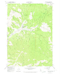
Other maps of this area

1894 · Idaho Basin
USGS Topo · 1:125,000

1955 · Hailey
USGS Topo · 1:250,000

1957 · Placerville
USGS Topo · 1:24,000

1957 · Pioneerville
USGS Topo · 1:24,000

1957 · Warm Springs Point
USGS Topo · 1:24,000

1957 · Idaho City
USGS Topo · 1:24,000

1959 · Hailey
USGS Topo · 1:250,000

1962 · Hailey
USGS Topo · 1:250,000

1964 · Twin Springs
USGS Topo · 1:24,000

1969 · Dunnigan Creek
USGS Topo · 1:24,000