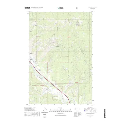
2020 Map of Idaho Gulch
USGS Topo · Published 2020About this map
Superior and Riverbend serve as the primary residential hubs along the Clark Fork river corridor, which carves a deep valley through the Lolo National Forest. The landscape is defined by a dense network of gulches and creeks, including Idaho Gulch, Shyrock Gulch, and Camp Four Gulch, all draining toward the river. Transportation and commerce are concentrated in the valley floor, where Interstate 90 and Mullan Rd E parallel the water, providing access to the Mineral County Airport.
Find a feature on this map
67 named features on this map. Tap any name to fly to it.
Don’t see what you’re looking for? This feature index may not catch every label — zoom into the map to look around manually.
Map Details
Editions of this 2020 Idaho Gulch Map
This is the sole edition of this map. No revisions or reprints were ever made.
Other maps of this area

1956 · Wallace
USGS Topo · 1:250,000

1959 · Tarkio
USGS Topo · 1:62,500

1959 · Perma
USGS Topo · 1:62,500

1959 · Plains
USGS Topo · 1:62,500

1960 · Wallace
USGS Topo · 1:250,000

1960 · Superior
USGS Topo · 1:62,500

1983 · Horsehead Peak
USGS Topo · 1:24,000
1983 · Tarkio
USGS Topo · 1:24,000
1984 · Knowles
USGS Topo · 1:24,000
1985 · Quinns Hot Springs
USGS Topo · 1:24,000