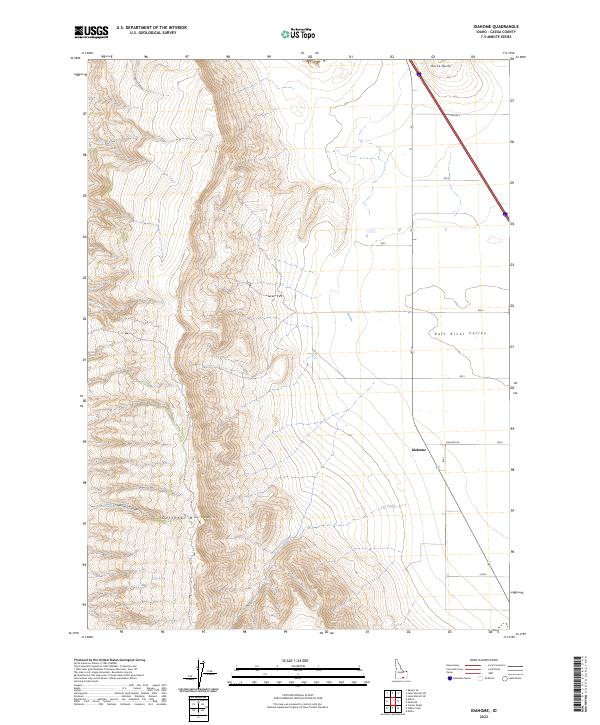
2023 Map of Idahome
USGS Topo · Published 2023About this map
Idahome sits at a crossroads in the eastern basin of the Raft River Valley, where the transition from high desert plains to the steep elevations of the Cotterel Mountains defines the landscape. This 2023 survey illustrates a classic high-country environment where water sources like Potter Spring and Parke Spring are vital markers for land use. To the north, Horse Butte rises as a prominent landmark above the valley floor. The map tracks the drainage patterns through Guinn Canyon and Harroun Canyon, which feed toward the valley. The intersection of Idahome Rd and 800 S serves as the focal point for the small settlement, which is surrounded by a grid of rural roads and section boundaries like t11s r26e that reflect the enduring influence of the Public Land Survey System on Idaho's ranching and agricultural geography.
Find a feature on this map
20 named features on this map. Tap any name to fly to it.
Don’t see what you’re looking for? This feature index may not catch every label — zoom into the map to look around manually.
Map Details
Editions of this 2023 Idahome Map
This is the sole edition of this map. No revisions or reprints were ever made.
Other maps of this area

1954 · Pocatello
USGS Topo · 1:250,000

1958 · Pocatello
USGS Topo · 1:250,000

1959 · Lake Walcott
USGS Topo · 1:62,500

1964 · Rupert SE
USGS Topo · 1:24,000

1968 · Malta NE
USGS Topo · 1:24,000

1968 · Malta
USGS Topo · 1:24,000

1968 · Idahome
USGS Topo · 1:24,000

1968 · Nibbs Creek
USGS Topo · 1:24,000

1968 · Albion
USGS Topo · 1:24,000
1968 · Connor Ridge
USGS Topo · 1:24,000