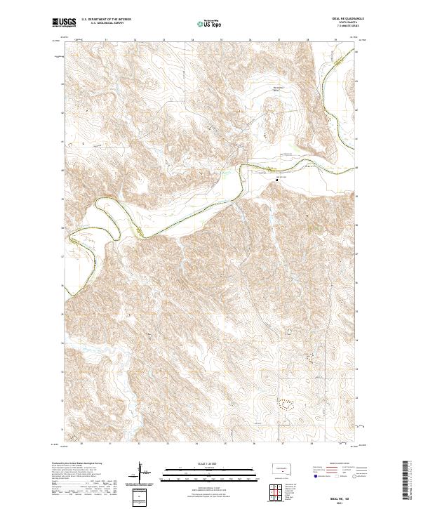
2021 Map of Ideal NE
USGS Topo · Published 2021About this map
The White River carves a winding path through the borderlands of Lyman and Tripp counties, defining the landscape with significant geologic features like Horseshoe Bend. This 2021 survey reveals a rural prairie environment structured by a grid of section lines and local thoroughfares, including Oak Hills Rd and Wagon Rd. The drainage network is further established by Davis Cr and Thunder Cr, which feed into the primary river valley.
Find a feature on this map
20 named features on this map. Tap any name to fly to it.
Don’t see what you’re looking for? This feature index may not catch every label — zoom into the map to look around manually.
Map Details
Editions of this 2021 Ideal NE Map
This is the sole edition of this map. No revisions or reprints were ever made.
Other maps of this area

1951 · Ideal NW
USGS Topo · 1:24,000

1951 · Ideal NE
USGS Topo · 1:24,000

1952 · Reliance SW
USGS Topo · 1:24,000

1952 · Hamill NW
USGS Topo · 1:24,000

1955 · Mitchell
USGS Topo · 1:250,000

1959 · Mitchell
USGS Topo · 1:250,000

1971 · Hamill
USGS Topo · 1:24,000

1978 · Kennebec SW
USGS Topo · 1:24,000
1978 · Kennebec SE
USGS Topo · 1:24,000

1982 · King Dam
USGS Topo · 1:25,000