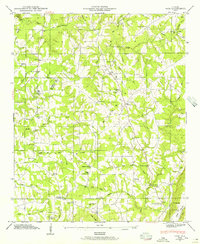
1946 Map of Ider
USGS Topo · Published 1956About this map
The plateau of Sand Mountain dominates this landscape on the Jackson Co and De Kalb Co line during the mid-1940s. The settlement pattern across the heights is defined by small agricultural hubs and family-named intersections like Skaggs Corner, Beaty Crossroads, and Biddle Crossroads. Local industry and rural utility are centered on water features, exemplified by Yorks Mill on Rock Creek and Old Blevins Mill to the east.
Find a feature on this map
72 named features on this map. Tap any name to fly to it.
Don’t see what you’re looking for? This feature index may not catch every label — zoom into the map to look around manually.
Map Details
Editions of this 1946 Ider Map
2 editions found
Other maps of this area

1886 · Stevenson
USGS Topo · 1:125,000

1892 · Stevenson
USGS Topo · 1:125,000

1895 · Stevenson
USGS Topo · 1:125,000

1936 · Trenton
USGS Topo · 1:24,000

1936 · Ider
USGS Topo · 1:24,000

1936 · Flat Rock
USGS Topo · 1:24,000

1936 · Dugout Valley
USGS Topo · 1:24,000

1936 · Sulphur Springs
USGS Topo · 1:24,000

1936 · Sylvania
USGS Topo · 1:24,000

1936 · Stevenson
USGS Topo · 1:24,000