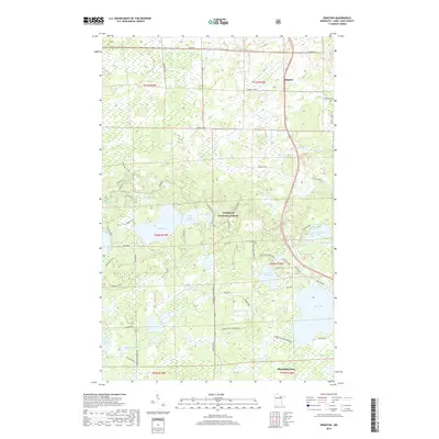
2019 Map of Idington
USGS Topo · Published 2019About this map
Idington sits at the northern edge of this landscape, positioned where the Rice River crosses under the highway near the Idington Cem. This portion of the Superior National Forest is defined by an extensive network of glacial lakes and wetlands, ranging from the large Sand Lake and Lake Fourteen to smaller basins like Beaver Lake and Candle Lake. The terrain is marked by the Laurentian Snowmobile trail, which cuts a path through the dense timber and low-lying bogs.
Find a feature on this map
44 named features on this map. Tap any name to fly to it.
Don’t see what you’re looking for? This feature index may not catch every label — zoom into the map to look around manually.
Map Details
Editions of this 2019 Idington Map
This is the sole edition of this map. No revisions or reprints were ever made.
Other maps of this area

1951 · Virginia
USGS Topo · 1:24,000

1951 · Kinney
USGS Topo · 1:24,000

1951 · Britt
USGS Topo · 1:24,000

1952 · Idington
USGS Topo · 1:24,000

1954 · Hibbing
USGS Topo · 1:250,000

1955 · Dark Lake
USGS Topo · 1:24,000

1955 · Dewey Lake SE
USGS Topo · 1:24,000

1957 · Hibbing
USGS Topo · 1:250,000

1958 · Hibbing
USGS Topo · 1:250,000

1964 · Hibbing
USGS Topo · 1:250,000