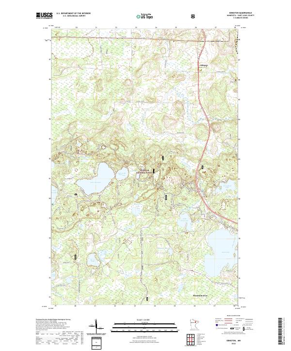
2022 Map of Idington
USGS Topo · Published 2022About this map
The settlement of Idington and the nearby Idington Cem anchor the northeast corner of this map, situated along a landscape defined by timber and water within the Superior National Forest. This section of St. Louis County is characterized by a dense network of forest roads and namesake trails, such as Samuelson Spur I Trl and Kinney Spur Trl, reflecting the region's long-standing forestry and recreation focus.
Find a feature on this map
79 named features on this map. Tap any name to fly to it.
Don’t see what you’re looking for? This feature index may not catch every label — zoom into the map to look around manually.
Map Details
Editions of this 2022 Idington Map
This is the sole edition of this map. No revisions or reprints were ever made.
Other maps of this area

1951 · Virginia
USGS Topo · 1:24,000

1951 · Kinney
USGS Topo · 1:24,000

1951 · Britt
USGS Topo · 1:24,000

1952 · Idington
USGS Topo · 1:24,000

1954 · Hibbing
USGS Topo · 1:250,000

1955 · Dark Lake
USGS Topo · 1:24,000

1955 · Dewey Lake SE
USGS Topo · 1:24,000

1957 · Hibbing
USGS Topo · 1:250,000

1958 · Hibbing
USGS Topo · 1:250,000

1964 · Hibbing
USGS Topo · 1:250,000