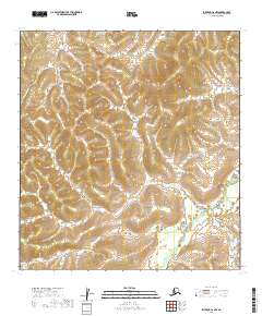
2019 Map of Iditarod C-6 NW
USGS Topo · Published 2019About this map
Big Yetna River winds through this sparsely labeled interior portion of the Yukon-Koyukuk Census Area, defining the primary drainage pattern of the landscape. The geography is characterized by an intricate network of ridgelines and valleys, largely devoid of named human infrastructure or settlements. This part of the Iditarod region is represented primarily through its natural topography and township boundaries, including t30n r51w and t31n r52w. The concentration of the Yetna River system in the lower-right corner highlights a terrain dominated by hydrologic flow rather than overland development, providing a clean record of the land's contours and elevation before any modern industrial footprint.
Find a feature on this map
8 named features on this map. Tap any name to fly to it.
Don’t see what you’re looking for? This feature index may not catch every label — zoom into the map to look around manually.
Map Details
Editions of this 2019 Iditarod C-6 NW Map
This is the sole edition of this map. No revisions or reprints were ever made.
Other maps of this area

1951 · Holy Cross
USGS Topo · 1:250,000

1951 · Iditarod
USGS Topo · 1:250,000

1952 · Holy Cross C-1
USGS Topo · 1:63,360

1952 · Holy Cross D-1
USGS Topo · 1:63,360

1952 · Holy Cross
USGS Topo · 1:250,000

1954 · Iditarod D-6
USGS Topo · 1:63,360
1954 · Iditarod C-6
USGS Topo · 1:63,360

1956 · Iditarod
USGS Topo · 1:250,000
2019 · Iditarod C-6 NE
USGS Topo · 1:25,000
2019 · Holy Cross C-1 NE
USGS Topo · 1:25,000