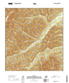
2019 Map of Iditarod D-1 SE
USGS Topo · Published 2019About this map
The Kuskokwim Mountains define the western landscape of this remote interior region, anchored by the prominent peak of Mt Joaquin. This terrain is characterized by a dense network of wetlands and drainage patterns typical of the Alaskan wilderness, where the Tatalina River meanders across the eastern flats. The map documents a territory defined by its natural watercourses rather than human infrastructure, as the valley floor is dominated by the winding path of the river and smaller tributaries like Carl Cr. These features provide a record of the hydrological and topographic character of the Yukon-Koyukuk Census Area, illustrating how the mountains transition into the expansive river basins of the interior.
Find a feature on this map
8 named features on this map. Tap any name to fly to it.
Don’t see what you’re looking for? This feature index may not catch every label — zoom into the map to look around manually.
Map Details
Editions of this 2019 Iditarod D-1 SE Map
This is the sole edition of this map. No revisions or reprints were ever made.
Other maps of this area

1949 · McGrath
USGS Topo · 1:250,000

1950 · McGrath
USGS Topo · 1:250,000

1951 · Iditarod
USGS Topo · 1:250,000

1954 · McGrath D-6
USGS Topo · 1:63,360

1954 · McGrath C-6
USGS Topo · 1:63,360
1954 · Iditarod D-1
USGS Topo · 1:63,360
1955 · Iditarod D-1
USGS Topo · 1:63,360
1956 · Iditarod C-1
USGS Topo · 1:63,360

1956 · Iditarod
USGS Topo · 1:250,000

1958 · McGrath
USGS Topo · 1:250,000