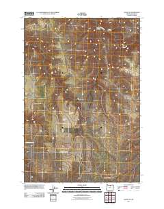
2011 Map of Igo Butte
USGS Topo · Published 2011About this map
The dry, dissected plateau of Igo Butte dominates this part of Gilliam County, where high-desert canyons and drainage channels define the rural landscape. Long-standing land use is anchored by the H Johnson Ranch, situated near the intersection of Alville Rd and Ferry Canyon Rd. The presence of the Igo Cemetery suggests an earlier era of community life and settlement that preceded the modern ranching operations. The terrain is deeply carved by watercourses such as Hay Creek and topographical depressions like Tenmile Canyon and Corral Hollow. This survey provides a clear view of the transportation network connecting these remote sites, including the winding paths of Igo Rd and Lamberson Canyon Rd as they navigate the ridges and canyon floors.
Find a feature on this map
11 named features on this map. Tap any name to fly to it.
Don’t see what you’re looking for? This feature index may not catch every label — zoom into the map to look around manually.
Map Details
Editions of this 2011 Igo Butte Map
This is the sole edition of this map. No revisions or reprints were ever made.
Other maps of this area

1916 · Condon
USGS Topo · 1:125,000

1953 · The Dalles
USGS Topo · 1:250,000

1956 · The Dalles
USGS Topo · 1:250,000

1957 · The Dalles
USGS Topo · 1:250,000

1970 · Devils Backbone
USGS Topo · 1:24,000

1970 · Igo Butte
USGS Topo · 1:24,000
1970 · Schott Canyon
USGS Topo · 1:24,000

1970 · Condon
USGS Topo · 1:24,000
1970 · Shoestring Ridge
USGS Topo · 1:24,000
1970 · Gwendolen
USGS Topo · 1:24,000